MyTopo
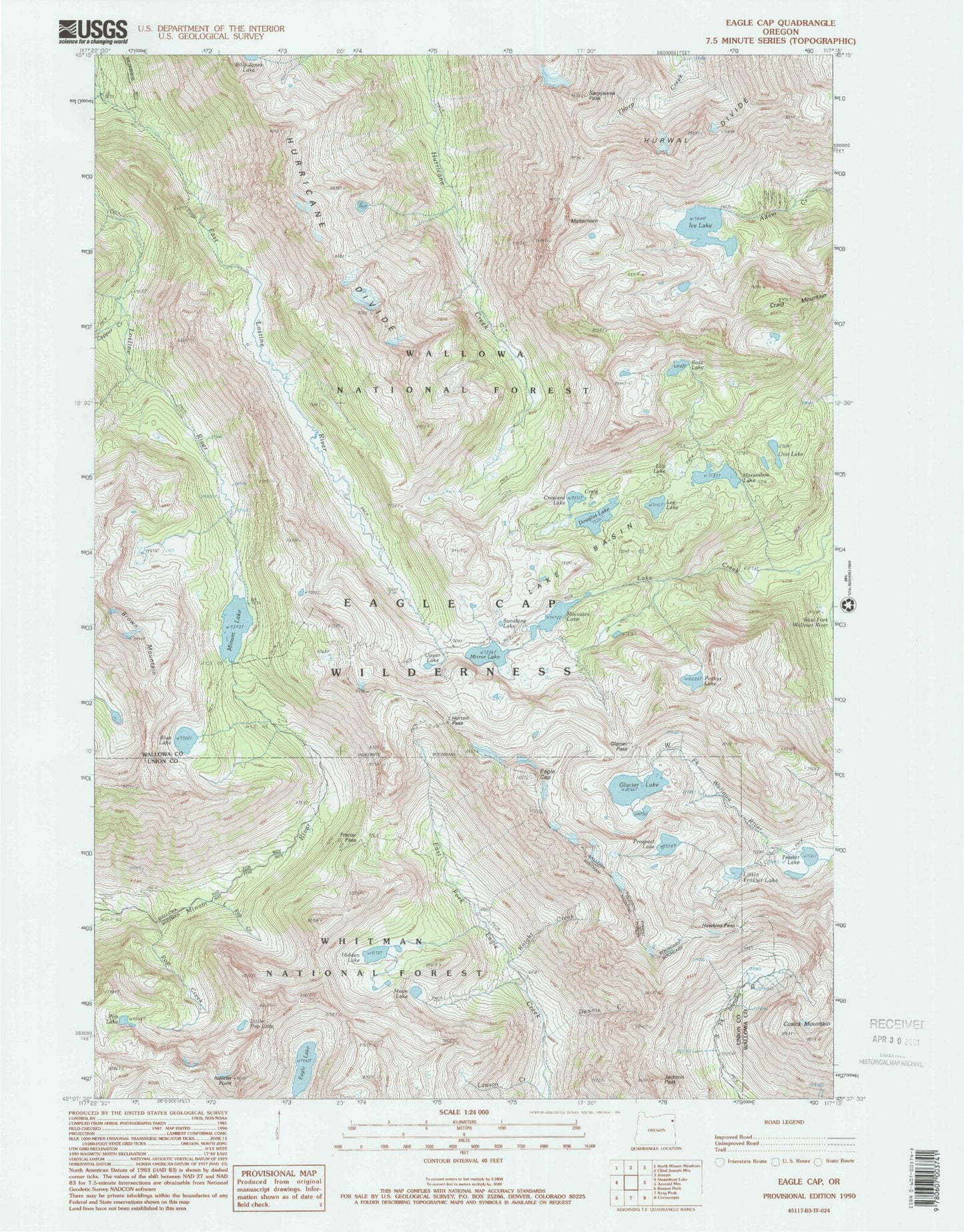
USGS Classic Eagle Cap Oregon 7.5'x7.5' Topo Map
Couldn't load pickup availability
Historical USGS topographic quad map of Eagle Cap in the state of Oregon. Scale: 1:24000. Print size: 24" x 27"
This quadrangle is in the following counties: Union, Wallowa.
The map contains contour lines, roads, rivers, towns, lakes, and grids including latitude / longitude and UTM / MGRS. Printed on high-quality waterproof paper with UV fade-resistant inks.
Contains the following named places: Granite Lake, Pocket Lake, Blue Lake, Brown Mountain, Copper Creek, Craig Lake, Craig Mountain, Crescent Lake, Dennis Creek, Douglas Lake, Eagle Cap, Eagle Lake, East Lostine River, Frazier Lake, Frazier Pass, Glacier Lake, Glacier Pass, Hawkins Pass, Hidden Lake, Horseshoe Lake, Horton Pass, Ice Lake, Jackson Peak, Knight Creek, Lake Basin, Lee Lake, Lilly Lake, Little Frazier Lake, Matterhorn, Minam Lake, Mirror Lake, Moccasin Lake, Moon Lake, Needle Point, Pop Creek, Prospect Lake, Razz Lake, River Head Camp (historical), Sacajawea Peak, Sunshine Lake, Unit Lake, Upper Lake, Wallowa Mountains, Minam Lake Dam, Eagle Lake Dam, Benson Glacier, Two Pan Trailhead, Pop Lake, Little Pop Lake