MyTopo
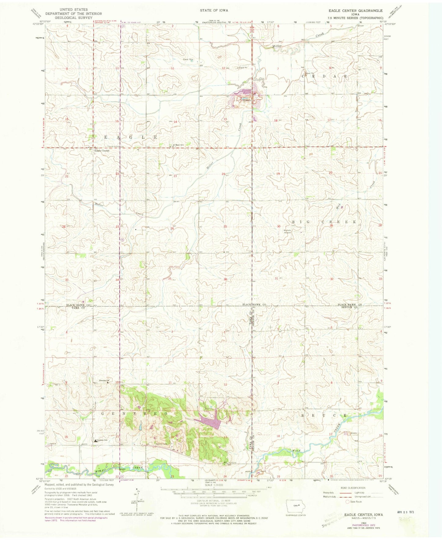
Classic USGS Eagle Center Iowa 7.5'x7.5' Topo Map
Couldn't load pickup availability
Historical USGS topographic quad map of Eagle Center in the state of Iowa. Map scale may vary for some years, but is generally around 1:24,000. Print size is approximately 24" x 27"
This quadrangle is in the following counties: Benton, Black Hawk, Tama.
The map contains contour lines, roads, rivers, towns, and lakes. Printed on high-quality waterproof paper with UV fade-resistant inks, and shipped rolled.
Contains the following named places: Eagle Cemetery, Eagle Center, Eagle Center Post Office, Evergreen, Fifteen Mile, Geneseo Cemetery, Geneseo Church, Hickory Hills Park, Hickory Hills Recreation Dam, Hill Cemetery, Louise, Louise Post Office, Millers Creek, Millers Creek Post Office, Nichols Airport, Saint Mary of Mount Carmel Cemetery, Saint Mary School, Spencer Cemetery, Township of Eagle, Township of Geneseo, Waterloo South Quarry