MyTopo
Classic USGS Eagle Eye Peak New Mexico 7.5'x7.5' Topo Map
Couldn't load pickup availability
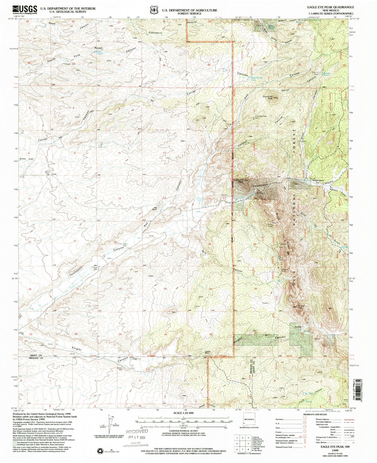
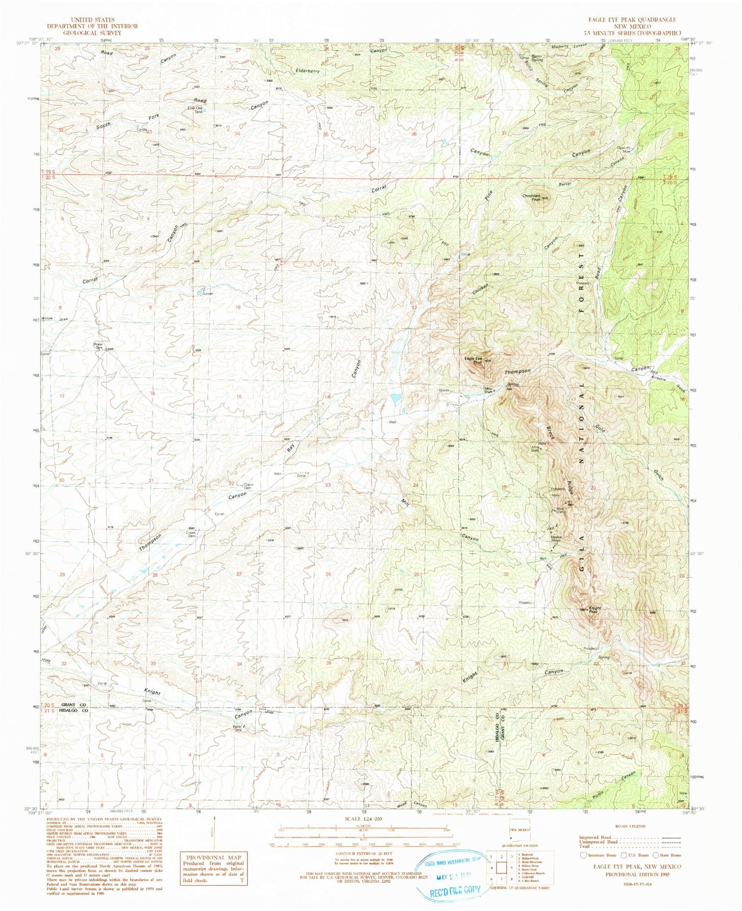
Historical USGS topographic quad map of Eagle Eye Peak in the state of New Mexico. Map scale may vary for some years, but is generally around 1:24,000. Print size is approximately 24" x 27"
This quadrangle is in the following counties: Grant, Hidalgo.
The map contains contour lines, roads, rivers, towns, and lakes. Printed on high-quality waterproof paper with UV fade-resistant inks, and shipped rolled.
Contains the following named places: Arrastre Gulch, Barrel Canyon, Bootleg Tank, Brock Ranch, Brock Ridge, Burro Spring, Chicken Canyon, Chocolate Peak, Chocolate Peak Dam, Cureton Ranch, Eagle Eye Peak, Fence Tank, Fred L Group, Gold Gulch, Knight Peak, Live Oak Tank, Lost Prospector Mine, Malone, Malone Mines, McCauley Ranch, Mill Canyon, Miller Spring, Mulberry Canyon, Pine Canyon, Ray Canyon, Ray Ranch, Road Canyon, Seep Canyon Tank, Thomson Canyon Perlite Deposit, Three Js Claims, Yankee Girl Mine