MyTopo
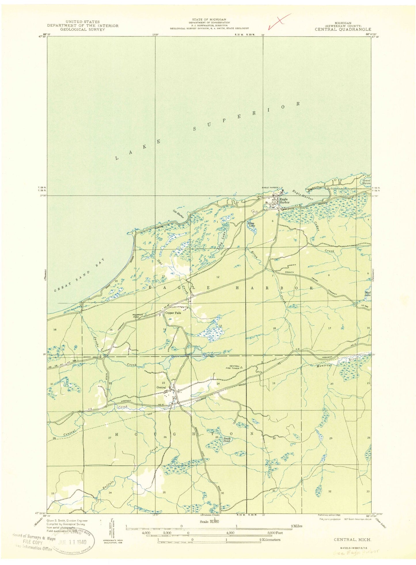
Classic USGS Eagle Harbor Michigan 7.5'x7.5' Topo Map
Couldn't load pickup availability
Historical USGS topographic quad map of Eagle Harbor in the state of Michigan. Typical map scale is 1:24,000, but may vary for certain years, if available. Print size: 24" x 27"
This quadrangle is in the following counties: Keweenaw.
The map contains contour lines, roads, rivers, towns, and lakes. Printed on high-quality waterproof paper with UV fade-resistant inks, and shipped rolled.
Contains the following named places: Beaver Pond, Buffalo Creek, Cat Harbor, Cedar Creek, Cedar Swamp, Central, Central Lake, Copper Falls, Copper Falls Lake, Eagle Harbor, Eagle Harbor, Eagle Harbor Lighthouse, Eliza Lake, Great Sand Bay, Jacobs Creek, Long Lake, Madison Gap, Meadow Lake, Montreal Meadows, Mud Creek, Owl Creek, Owl Lake, Pine Grove Cemetery, The Marshes, Eliza Creek, Nepco Camp Number 7, Eagle Harbor Marina, Eagle Harbor Post Office (historical), Eagle Harbor Post Office (historical), Central Mine Post Office (historical), Eagle Harbor House Historical Marker, Copper Falls, Jacobs Falls, Eagle Harbor Township Volunteer Fire Department Station 1 Headquarters, Eagle Harbor Census Designated Place, Beaver Pond, Buffalo Creek, Cat Harbor, Cedar Creek, Cedar Swamp, Central, Central Lake, Copper Falls, Copper Falls Lake, Eagle Harbor, Eagle Harbor, Eagle Harbor Lighthouse, Eliza Lake, Great Sand Bay, Jacobs Creek, Long Lake, Madison Gap, Meadow Lake, Montreal Meadows, Mud Creek, Owl Creek, Owl Lake, Pine Grove Cemetery, The Marshes, Eliza Creek, Nepco Camp Number 7, Eagle Harbor Marina, Eagle Harbor Post Office (historical), Eagle Harbor Post Office (historical), Central Mine Post Office (historical), Eagle Harbor House Historical Marker, Copper Falls, Jacobs Falls, Eagle Harbor Township Volunteer Fire Department Station 1 Headquarters, Eagle Harbor Census Designated Place


