MyTopo
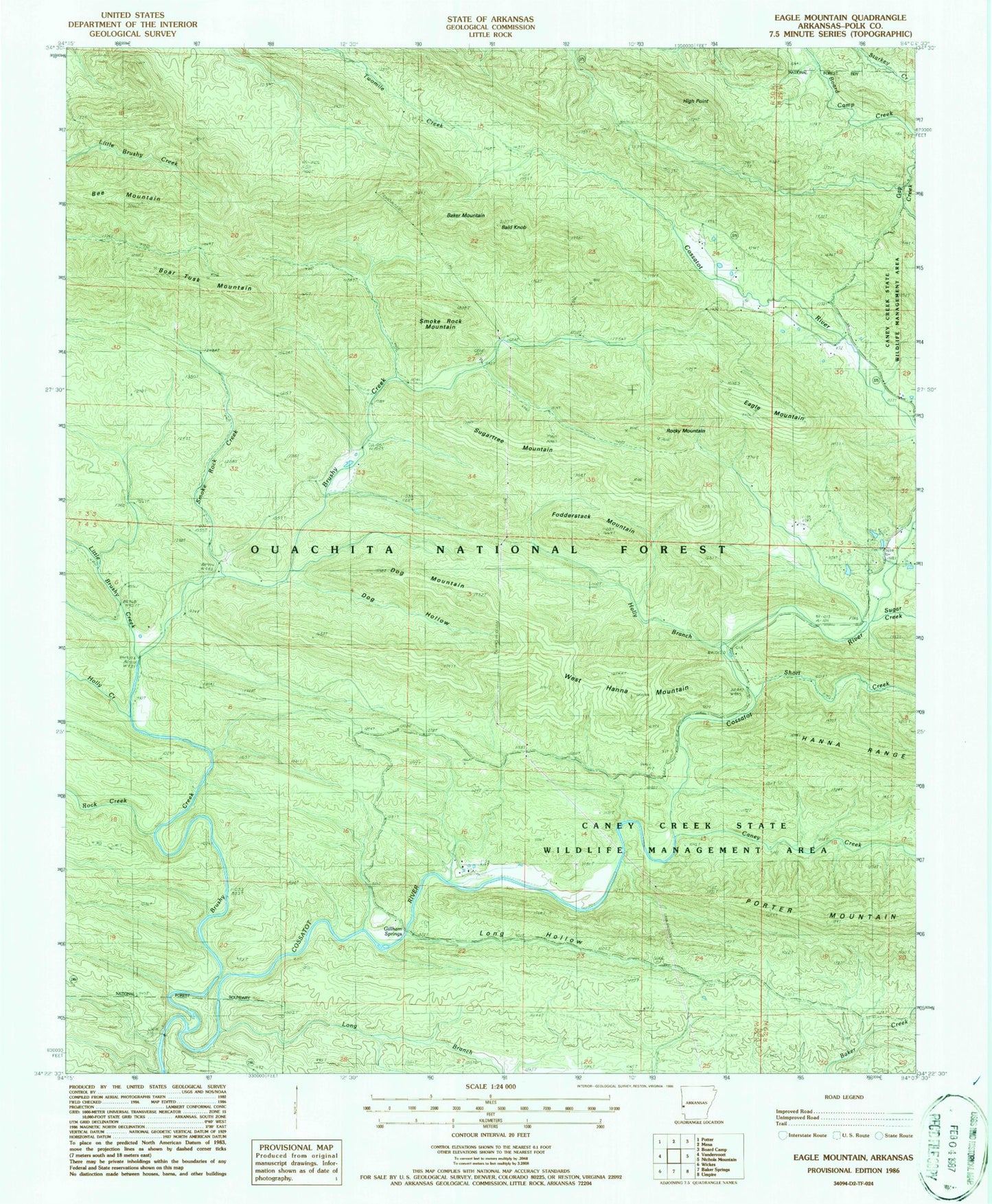
Classic USGS Eagle Mountain Arkansas 7.5'x7.5' Topo Map
Couldn't load pickup availability
Historical USGS topographic quad map of Eagle Mountain in the state of Arkansas. Typical map scale is 1:24,000, but may vary for certain years, if available. Print size: 24" x 27"
This quadrangle is in the following counties: Polk.
The map contains contour lines, roads, rivers, towns, and lakes. Printed on high-quality waterproof paper with UV fade-resistant inks, and shipped rolled.
Contains the following named places: Holly Creek, Polk County, Baker Mountain, Bald Knob, Bee Mountain, Boar Tusk Mountain, Brushy Creek, Caney Creek, Dog Hollow, Dog Mountain, Eagle Mountain, Fodderstack Mountain, Gillham Springs, High Point, Holly Branch, Little Brushy Creek, Long Branch, Long Hollow, Rock Creek, Rocky Mountain, Short Creek, Smoke Rock Creek, Smoke Rock Mountain, Sugar Creek, Sugartree Mountain, West Hanna Mountain, Cossatot Wild and Scenic River