MyTopo
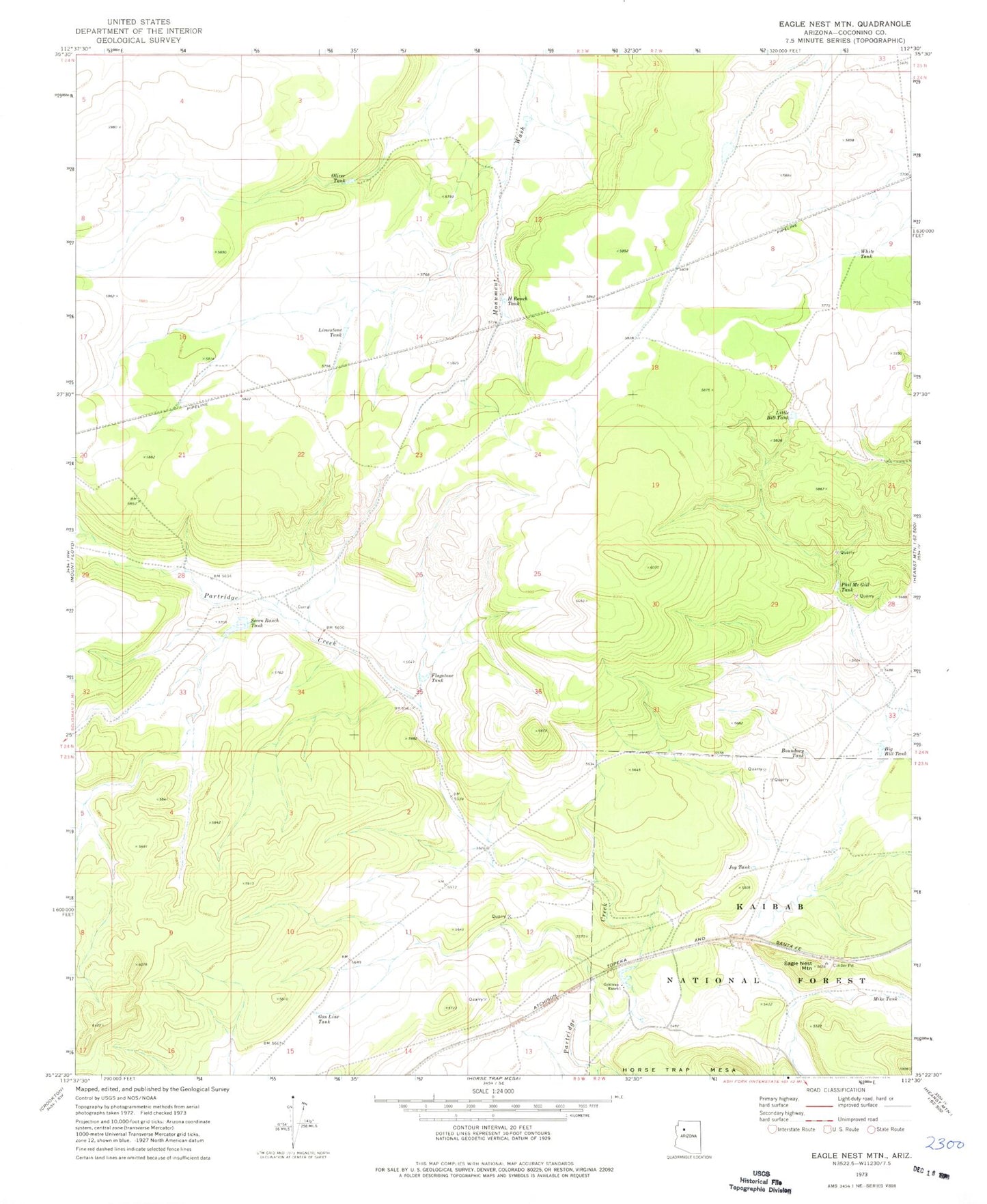
Classic USGS Eagle Nest Mountain Arizona 7.5'x7.5' Topo Map
Couldn't load pickup availability
Historical USGS topographic quad map of Eagle Nest Mountain in the state of Arizona. Map scale may vary for some years, but is generally around 1:24,000. Print size is approximately 24" x 27"
This quadrangle is in the following counties: Coconino.
The map contains contour lines, roads, rivers, towns, and lakes. Printed on high-quality waterproof paper with UV fade-resistant inks, and shipped rolled.
Contains the following named places: Big Bill Tank, Big Freeman Tank, Boundary Tank, Chunin Tank, Eagle Nest Mountain, Eagle Nest Railroad Station, Flagstone Tank, Gas Line Tank, Goldtrap Ranch, Goldtrap Tank, H Ranch Tank, Horse Tank, Joy Tank, Limestone Tank, Little Bill Tank, Mike Tank, Oliver Tank, Phil McGill Tank, Railroad Tank, Russell Quarry, Russell Tank, Seven Ranch Tank, Ship Dam Tank, Strawberry Tank, White Tank