MyTopo
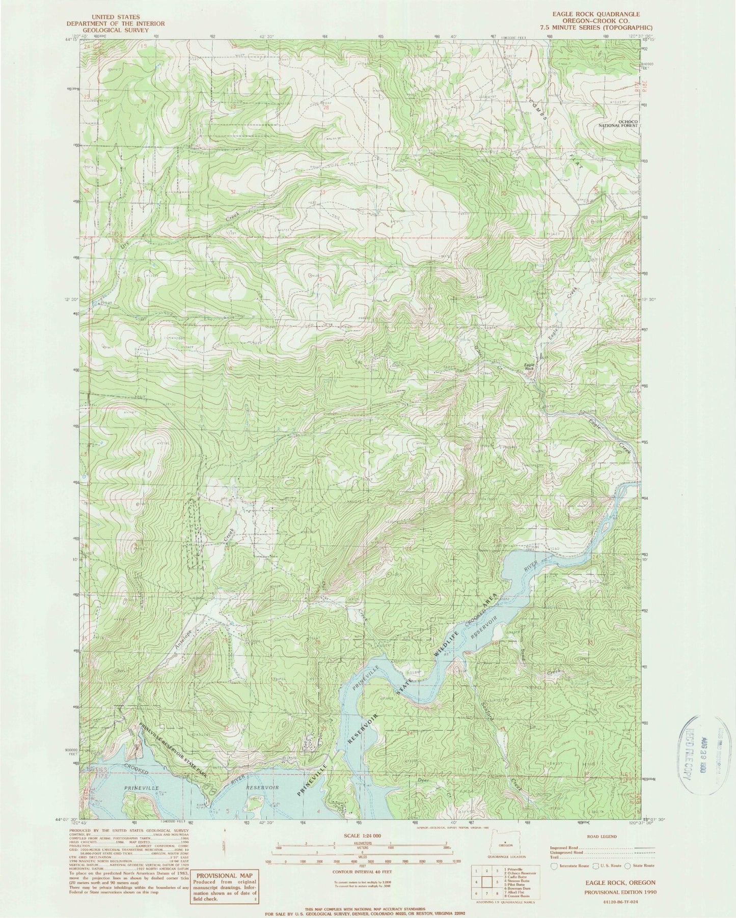
Classic USGS Eagle Rock Oregon 7.5'x7.5' Topo Map
Couldn't load pickup availability
Historical USGS topographic quad map of Eagle Rock in the state of Oregon. Map scale may vary for some years, but is generally around 1:24,000. Print size is approximately 24" x 27"
This quadrangle is in the following counties: Crook.
The map contains contour lines, roads, rivers, towns, and lakes. Printed on high-quality waterproof paper with UV fade-resistant inks, and shipped rolled.
Contains the following named places: Antelope Creek, Bailey School, Big Bend Island, Carey Ranch, Deer Creek, Eagle Creek, Eagle Rock, Jasper Point Boat Ramp, Klaus Ranch, Long Hollow, Mayfield Ranch, O'Neil Creek, Owl Creek, Prineville Reservoir, Prineville Reservoir State Park Marina, Prinville Reservoir State Park Boat Ramp, Roberts Bay Boat Launch, Sand Creek, Sanford Creek, Way Ranch