MyTopo
Classic USGS Eagles Mere Pennsylvania 7.5'x7.5' Topo Map
Couldn't load pickup availability
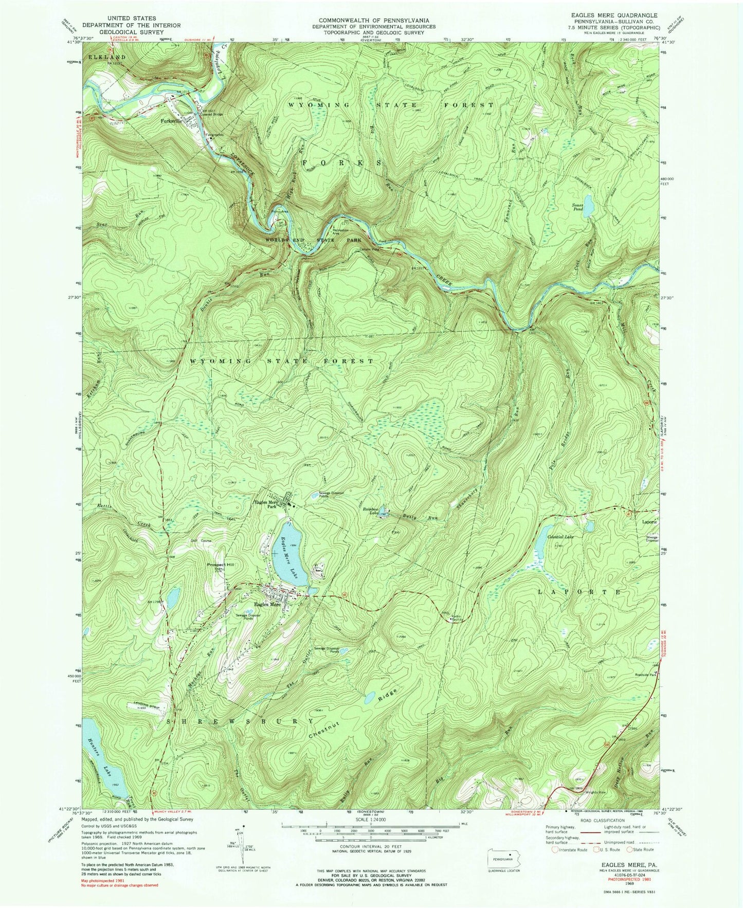
Historical USGS topographic quad map of Eagles Mere in the state of Pennsylvania. Typical map scale is 1:24,000, but may vary for certain years, if available. Print size: 24" x 27"
This quadrangle is in the following counties: Sullivan.
The map contains contour lines, roads, rivers, towns, and lakes. Printed on high-quality waterproof paper with UV fade-resistant inks, and shipped rolled.
Contains the following named places: Eagles Mere Field, Hunters Lake Dam, Sones Pond Dam, Sullivan Highland School, Crestmont, Ash Ridge Spur, Bear Run, Big Run, Big Run Spur, Celestial Lake, Chestnut Ridge, Coal Run, Crane Spur, Double Run, Eagles Mere Lake, Eagles Mere Park, Forksville, Fox Hollow Spur, High Rock Run, High Rock Spur, Hunters Lake, Irish Settlement Trail, Mackeys Run, Pole Bridge Run, Prospect Hill, Rainbow Lake, Rusty Run, Shanerburg Run, Sones Pond, Sugar Camp Spur, Tamarack Run, Wenonan Falls, World End Trail, Little Loyalsock Creek, Loyalsock Trail, Mill Creek, Worlds End State Park, Labyrinth, Haystacks, Devils Garden, Cold Run Road Falls, Lovers Rock, Castle Rock, Pole Hill, Rock Garden, Canyon Vista, Wrights View, Double Run Trail, Eagles Mere Golf Course, Pole Bridge Trail, Rock Run Trail, Big Timber Spur, Sullivan County, Eagles Mere, Borough of Eagles Mere, Borough of Forksville, Township of Shrewsbury, Eagles Mere Chautauqua Post Office (historical), Crestmont Post Office (historical), Merritt Field, Forksville Volunteer Fire Company Station 53, Eagles Mere Volunteer Fire Company Station 51, Forksville Post Office, Eagles Mere Post Office