
MyTopo
Classic USGS Eagletown Oklahoma 7.5'x7.5' Topo Map
Couldn't load pickup availability
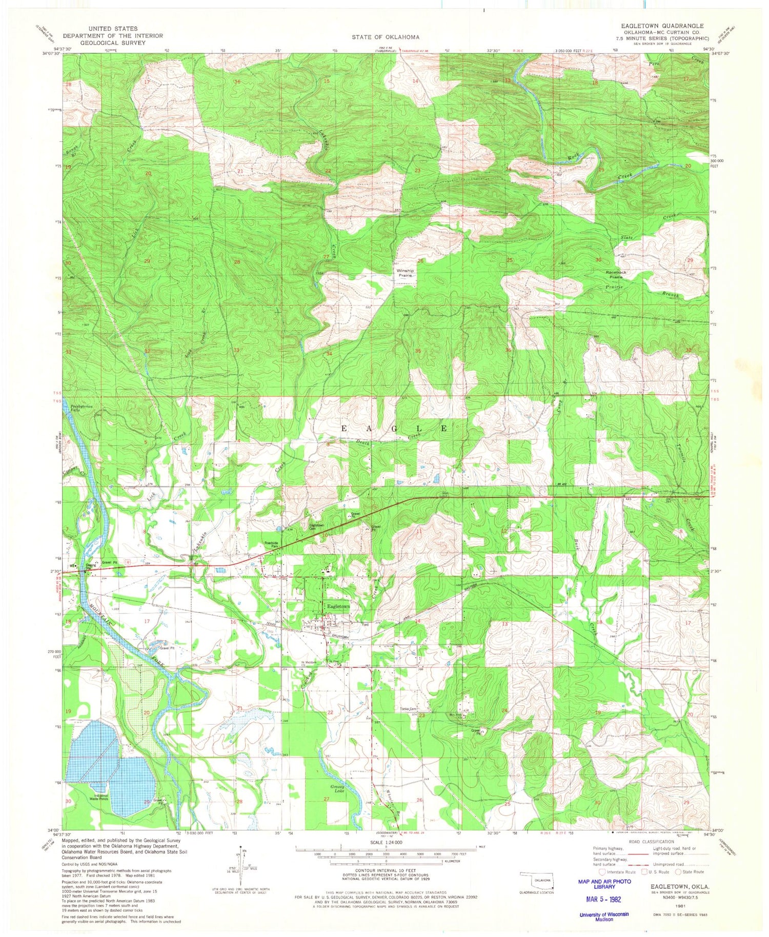
Historical USGS topographic quad map of Eagletown in the state of Oklahoma. Map scale may vary for some years, but is generally around 1:24,000. Print size is approximately 24" x 27"
This quadrangle is in the following counties: McCurtain.
The map contains contour lines, roads, rivers, towns, and lakes. Printed on high-quality waterproof paper with UV fade-resistant inks, and shipped rolled.
Contains the following named places: Buck Creek Landing, Camp Branch, Cooper Creek, Death Creek, Eagletown, Eagletown Cemetery, Eagletown Census Designated Place, Eagletown Elementary School, Eagletown High School, Eagletown Post Office, Eagletown Volunteer Fire Department, Grassy Lake, Lick Creek, Liksuklo Creek, Mountain Fork Cemetery, Mountain Fork Church, Oknoname 089013 Dam, Oknoname 089013 Reservoir, Presbyterian Falls, Racetrack Prairie, Saint Paul Church, Tonka Cemetery, Winship Prairie, ZIP Code: 74734


