MyTopo
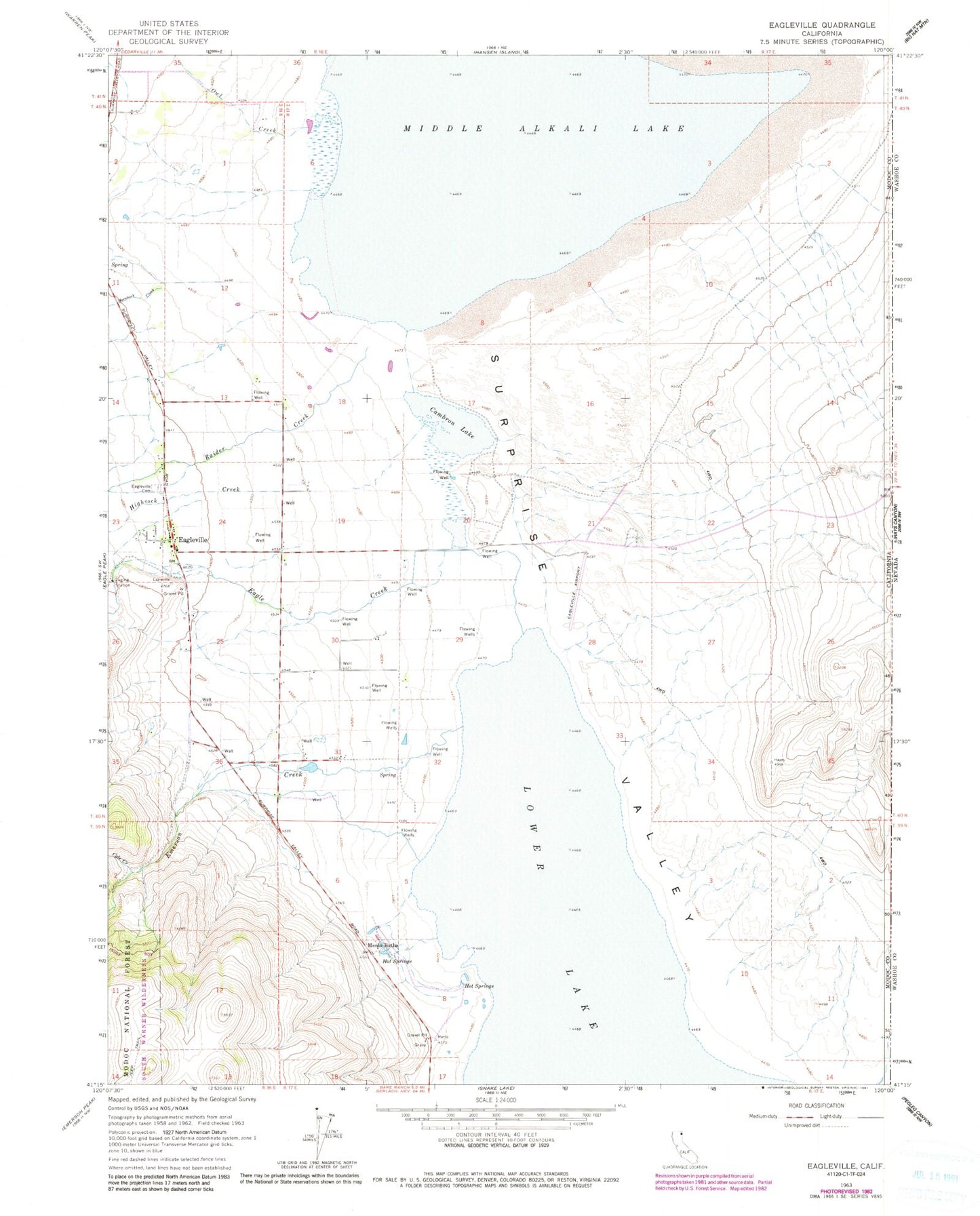
Classic USGS Eagleville California 7.5'x7.5' Topo Map
Couldn't load pickup availability
Historical USGS topographic quad map of Eagleville in the state of California. Map scale may vary for some years, but is generally around 1:24,000. Print size is approximately 24" x 27"
This quadrangle is in the following counties: Modoc, Washoe.
The map contains contour lines, roads, rivers, towns, and lakes. Printed on high-quality waterproof paper with UV fade-resistant inks, and shipped rolled.
Contains the following named places: Cambron Lake, Cockrell Ranch, Cole Creek, Eagle Creek, Eagleville, Eagleville Airport, Eagleville Cemetery, Eagleville Census Designated Place, Eagleville Fire Department, Emerson Creek, Highrock Creek, Hornback Creek, Menlo Baths, Midra Ranch, Mount Stevenson Ranch, Owl Creek, Raider Creek, ZIP Code: 96110