MyTopo
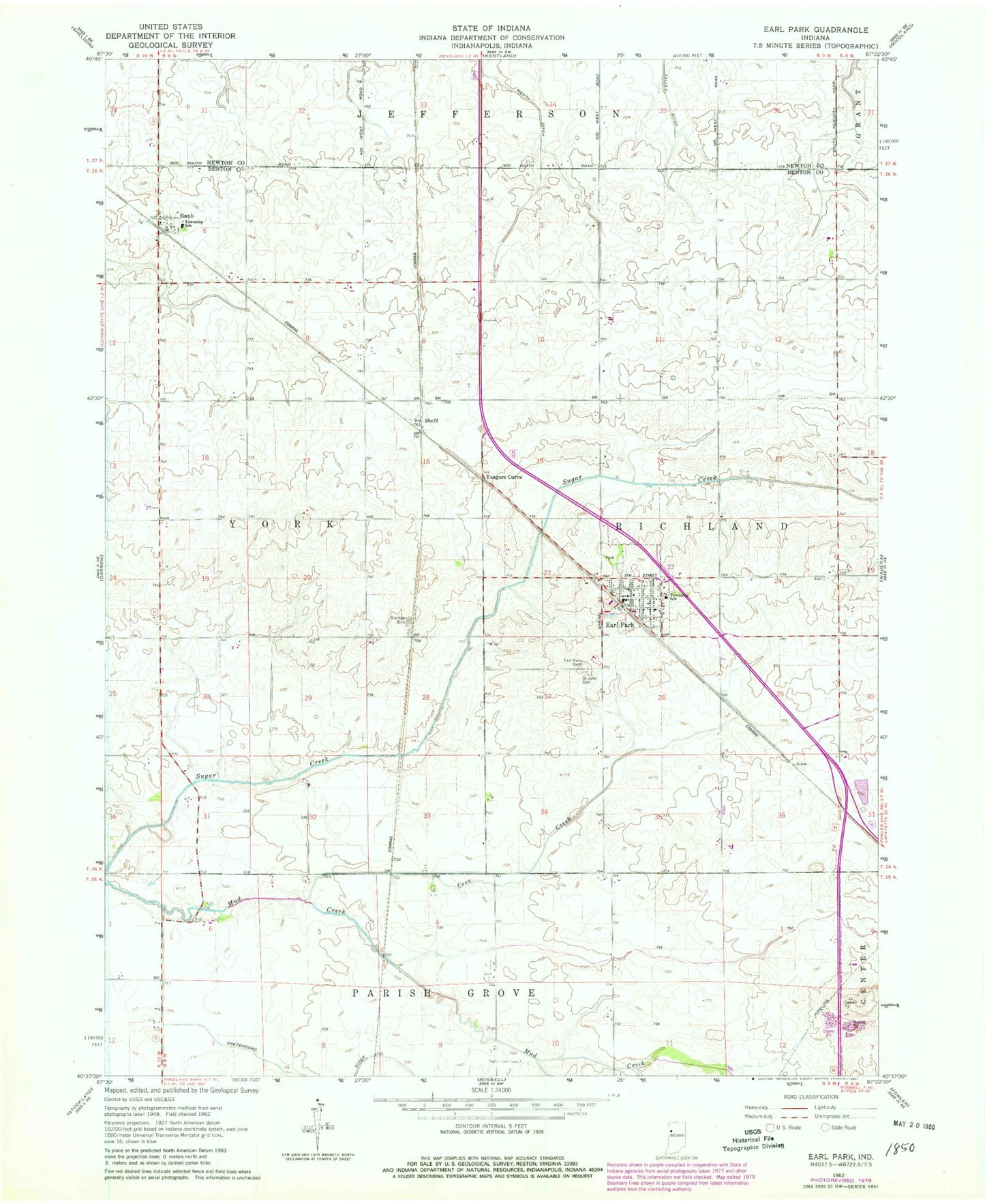
Classic USGS Earl Park Indiana 7.5'x7.5' Topo Map
Couldn't load pickup availability
Historical USGS topographic quad map of Earl Park in the state of Indiana. Map scale may vary for some years, but is generally around 1:24,000. Print size is approximately 24" x 27"
This quadrangle is in the following counties: Benton, Newton.
The map contains contour lines, roads, rivers, towns, and lakes. Printed on high-quality waterproof paper with UV fade-resistant inks, and shipped rolled.
Contains the following named places: Coon Creek, Earl Park, Earl Park Cemetery, Earl Park Post Office, Gretencord Ditch, Raub, Raub Census Designated Place, Rheude Airport, Richland Township Fire Department, Saint John the Baptist Cemetery, Sheff, Sumner Cemetery, Talley Ditch, Town of Earl Park, Township of Richland, Township of York, Yeagers Curve, ZIP Code: 47942