MyTopo
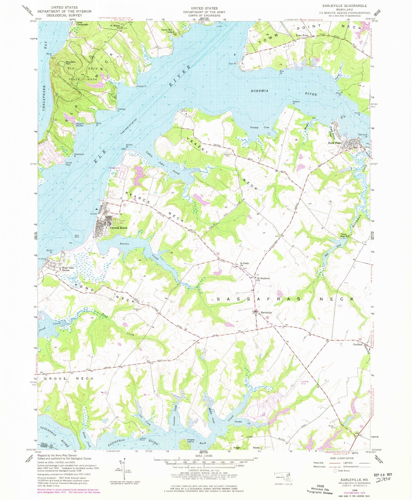
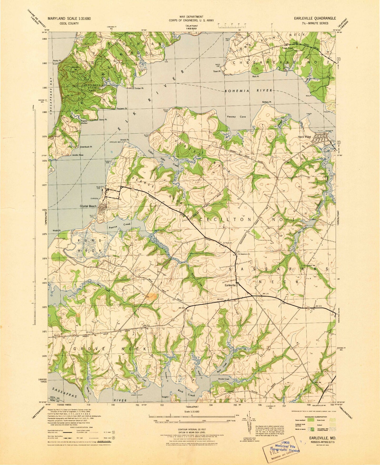
Classic USGS Earleville Maryland 7.5'x7.5' Topo Map
Couldn't load pickup availability
Historical USGS topographic quad map of Earleville in the state of Maryland. Typical map scale is 1:24,000, but may vary for certain years, if available. Print size: 24" x 27"
This quadrangle is in the following counties: Cecil, Kent.
The map contains contour lines, roads, rivers, towns, and lakes. Printed on high-quality waterproof paper with UV fade-resistant inks, and shipped rolled.
Contains the following named places: Arnold Point, Back Creek, Battery Point, Bohemia River, Cassidy Wharf, Cox Creek, Dowdel Creek, Earleville, Foreman Creek, Greenbush Point, Grove Neck, Jacobs Nose, Knight Island, Long Point, McGill Creek, Mill Pond, Morgan Creek, Old Hack Point, Parlor Point, Pond Neck, Pooles Creek, Rich Point, Rocky Point, Rogues Harbor, Saint Marks Church, Saint Pauls Church, Saint Stephens Church, Sandy Hill Camp, Sassafras Neck, Stony Point, Stony Point, Sweet Potato Creek, Thackery Point, Timber Point, Town Point, Town Point Neck, Veazey Family Cemetery, Veazey Cove, Veazey Neck, Wroth Point, Back Creek, White Banks, Buttonwood Beach, Cabin John Creek, Pearce Creek, Pearce Neck, Elk Neck State Park, Antler Creek, Battery Point Farms, Bay View Estates, Beach Fishery, Beaver Dam Fishery, Bohemia Acres, Bohemia Country Club, Camp Brisson, Cassidy Wharf, Collins Fishery, Earleville Wildlife Management Area, Ford Landing, Green Briar, Grove Neck School (historical), Hacks Point Acres, Honeysuckle Knoll, Indian Acres, Indian Cabin Fishery, Jamisons School (historical), John Town, Mount Harmon, Mount Pleasant Farm, Queens Point, Reybold Wharf, Saint Pauls United Methodist Cemetery, Saint Stephens Episcopal Cemetery, Scotchmans Glen, Snow Hill (historical), Sunset Point, The Woods of Town Point, Timber Neck, Tower Point, Two Rivers, Veazey Fishery, Wapiti Creek, Wilsons Fishery, Hack Point, Mauldin Mountain, Town Point, Camp Chesapeake (historical), Frazers Lake Dam, Pearce Creek Disposal Area Dam, Pearce Creek Disposal Area Lake, Panagopulos Farm Pond Dam, Camp Red Mill (historical), White Crystal Beach, West View Shores, Crawford Acres (historical), Stemmers Run Wildlife Management Area (historical), Town Point Methodist Church, Two Rivers Marina, Bohemia Vista Marina, Bohemia River Marina, Hexton Farms Airport, Earleville Post Office, Back Creek, Downs Branch, Goldsmiths Branch, Huckleberry Point, Mulberry Dock (historical), Sassafras Neck Methodist Church (historical), Scotchmans Creek Bridge, District 1 Cecilton, Hacks Point Fire Company, Long Point Marina, Richmonds Marina, Cassidy Wharf Farm, Wil-O-Mar Farms, Ford Farms, Chestnut Lane Farms