MyTopo
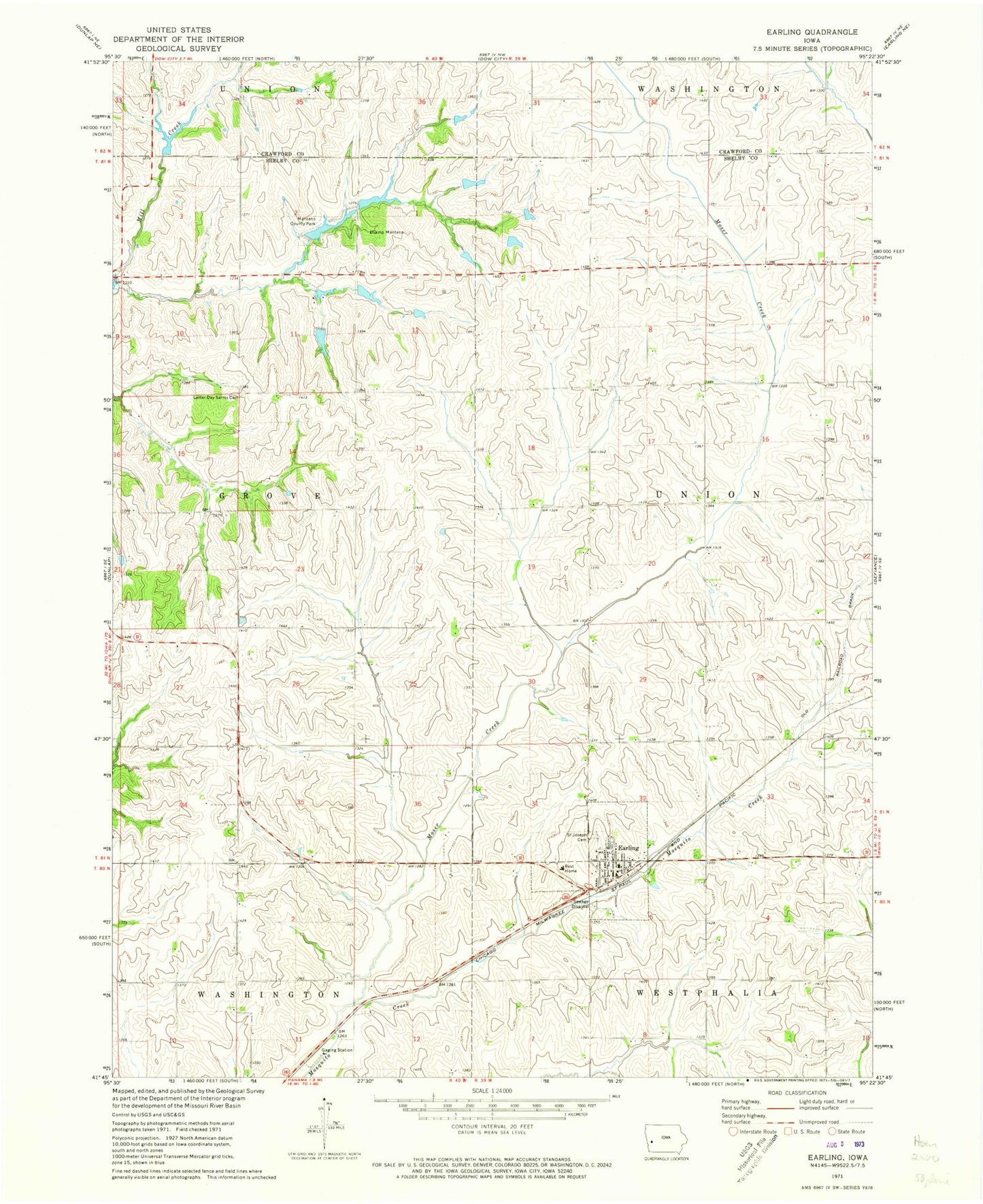
Classic USGS Earling Iowa 7.5'x7.5' Topo Map
Couldn't load pickup availability
Historical USGS topographic quad map of Earling in the state of Iowa. Map scale may vary for some years, but is generally around 1:24,000. Print size is approximately 24" x 27"
This quadrangle is in the following counties: Crawford, Shelby.
The map contains contour lines, roads, rivers, towns, and lakes. Printed on high-quality waterproof paper with UV fade-resistant inks, and shipped rolled.
Contains the following named places: Camp Manteno, City of Earling, Earling, Earling Grain and Feed Elevator, Earling Post Office, Earling Volunteer Fire Station, Gallands Grove RLDS Holcomb Cemetery, Little Flower Haven Nursing Home, Manteno County Park, Moser Creek, Poma, Pomo Post Office, Rosenow Timber Recreation Area, Saint Joseph Cemetery, Saint Joseph Church, Saint Joseph School, Schimerowski Recreation Area, Shelby Post Office, Shelbyville Post Office, Township of Grove, Township of Union, ZIP Code: 51530