
MyTopo
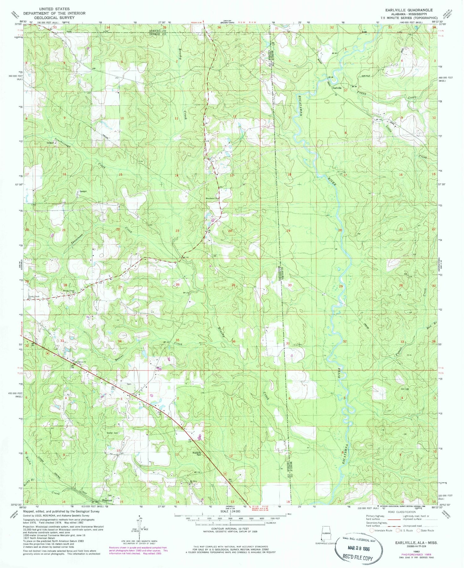
Classic USGS Earlville Alabama 7.5'x7.5' Topo Map
Couldn't load pickup availability
Historical USGS topographic quad map of Earlville in the states of Alabama, Mississippi. Map scale may vary for some years, but is generally around 1:24,000. Print size is approximately 24" x 27"
This quadrangle is in the following counties: George, Greene, Mobile.
The map contains contour lines, roads, rivers, towns, and lakes. Printed on high-quality waterproof paper with UV fade-resistant inks, and shipped rolled.
Contains the following named places: Beaver Creek, Brushy Creek, Brushy Creek Church, Cowart Cemetery, Dream Fields Airport, Earlville, Family Life Fellowship Church, Little Creek, Luce Fire Tower, Macedonia Cemetery, Macedonia Missionary Baptist Church, Moffet Cemetery, Mount Olive Baptist Church, Mount Olive Cemetery, Oak Grove Baptist Church, Oak Grove Cemetery, Powell Creek, Puppy Creek, Rocky Branch, Rocky Creek Church, Scarborough Creek, Shipman, Shipman Cemetery, Shipman United Methodist Church, Shipman Volunteer Fire Department, Supervisor District 1, Tennessee Creek


