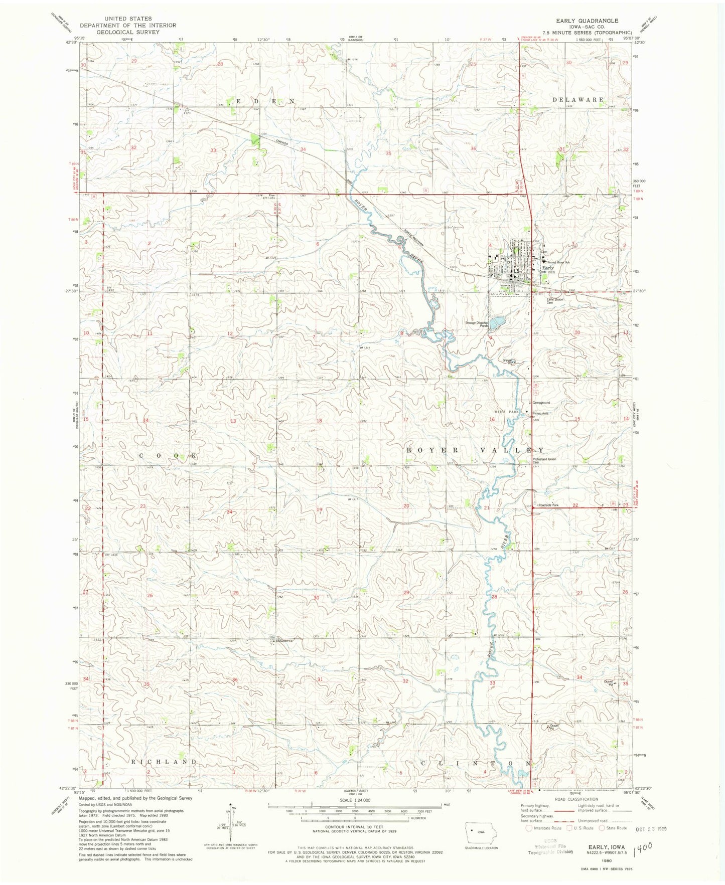
MyTopo
Classic USGS Early Iowa 7.5'x7.5' Topo Map
Couldn't load pickup availability
Historical USGS topographic quad map of Early in the state of Iowa. Map scale may vary for some years, but is generally around 1:24,000. Print size is approximately 24" x 27"
This quadrangle is in the following counties: Sac.
The map contains contour lines, roads, rivers, towns, and lakes. Printed on high-quality waterproof paper with UV fade-resistant inks, and shipped rolled.
Contains the following named places: Cedar Forks Post Office, City of Early, Early, Early Fire and Rescue, Early Post Office, Early Public Library, Early Union Cemetery, Faith Lutheran Church, Farmers Co-op Elevator, Immanuel Cemetery, Immanuel Church, Prairie Pedlar, Presbyterian Church, Protestant Union Cemetery, Reiff Park, Ridge View Middle School, Sacred Heart Catholic Church, Sacred Heart Cemetery, Sacred Heart Church, Sacred Heart School, Township of Boyer Valley, United Methodist Church, ZIP Code: 50535