
MyTopo
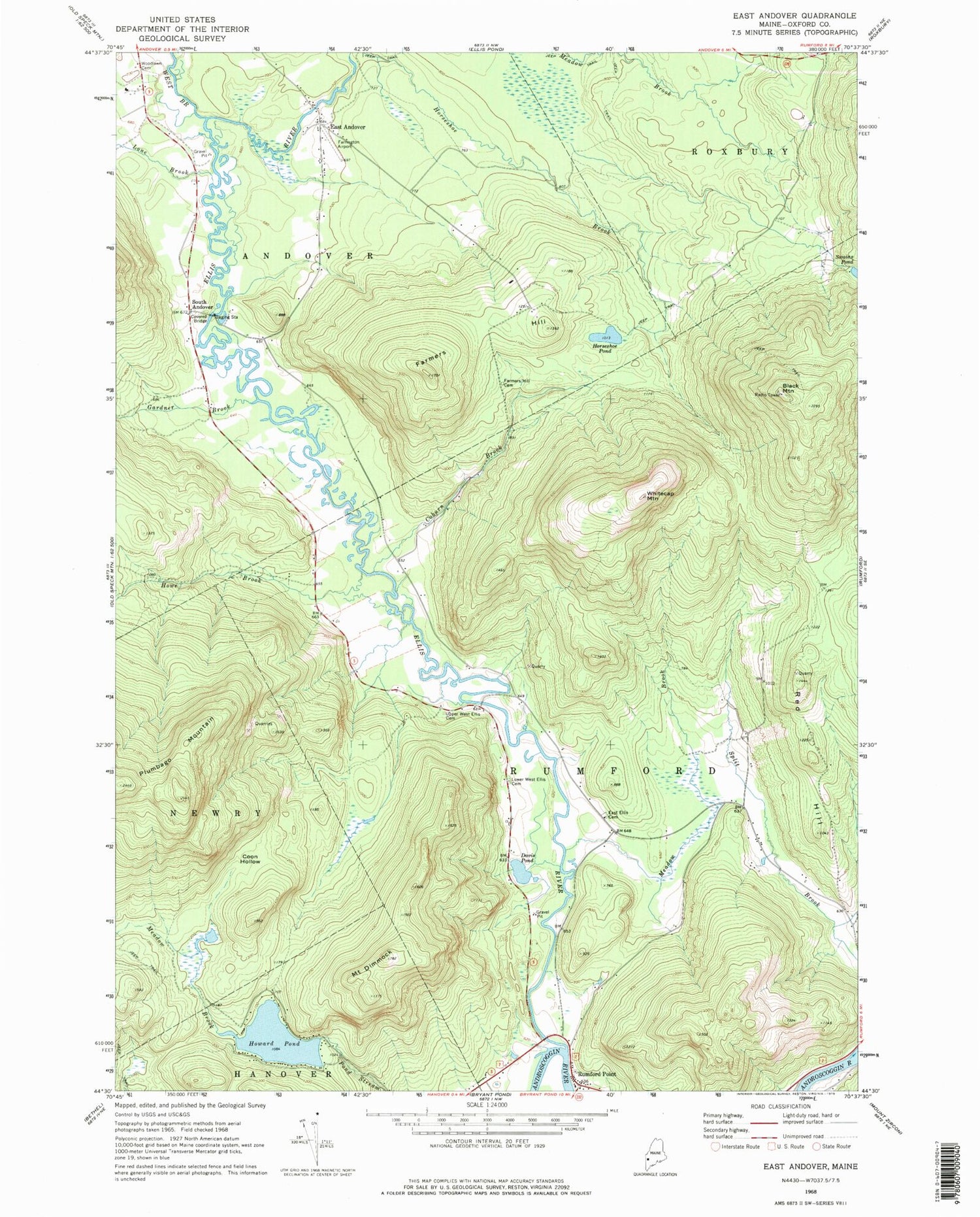
Classic USGS East Andover Maine 7.5'x7.5' Topo Map
Couldn't load pickup availability
Historical USGS topographic quad map of East Andover in the state of Maine. Typical map scale is 1:24,000, but may vary for certain years, if available. Print size: 24" x 27"
This quadrangle is in the following counties: Oxford.
The map contains contour lines, roads, rivers, towns, and lakes. Printed on high-quality waterproof paper with UV fade-resistant inks, and shipped rolled.
Contains the following named places: Black Mountain, Coburn Brook, Coon Hollow, Davis Pond, Mount Dimmock, East Andover, East Ellis Cemetery, Ellis River, Farmers Hill, Farmers Hill Cemetery, Gardner Brook, Horseshoe Pond, Howard Pond, Howe Brook, Lone Brook, Lower West Ellis Cemetery, Meadow Brook, Meadow Brook, Red Hill, Rumford Point, Upper West Ellis Cemetery, West Branch Ellis River, Whitecap Mountain, Woodlawn Cemetery, South Andover, WTBM-FM (Mexico), WWMR-FM (Rumford), Black Mountain of Maine Ski Area, East Andover Post Office, Farrington Airport (historical), Lovejoy Bridge, Newry Mine, Rumford Point Congregational Church, Andover Fire Department Substation, Rumford Point Cemetery


