MyTopo
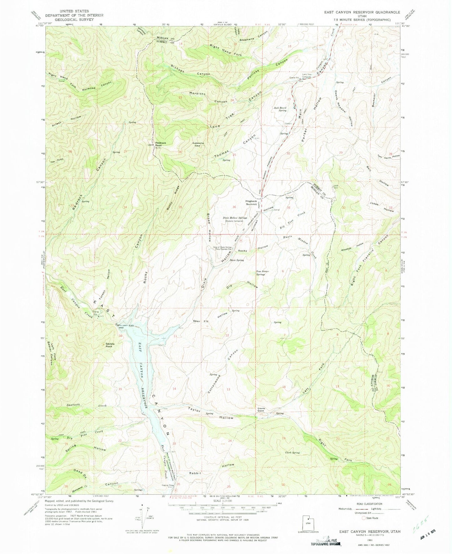
Classic USGS East Canyon Reservoir Utah 7.5'x7.5' Topo Map
Couldn't load pickup availability
Historical USGS topographic quad map of East Canyon Reservoir in the state of Utah. Map scale may vary for some years, but is generally around 1:24,000. Print size is approximately 24" x 27"
This quadrangle is in the following counties: Morgan, Summit.
The map contains contour lines, roads, rivers, towns, and lakes. Printed on high-quality waterproof paper with UV fade-resistant inks, and shipped rolled.
Contains the following named places: Big Tree Creek, Bishops Canyon, Broad Hollow, Clark Spring, Cottonwood Canyon, Dead Ox Canyon, Deer Fly Hollow, Dip Hollow, Dixie Hollow, Dixie Hollow Springs, Dixie Spring, Dry Pine Creek, East Canyon Campground, East Canyon Dam, East Canyon Reservoir, East Canyon State Park, Grants Grave, Hells Canyon, Hillman Hollow, Hogback Summit, Hunts Meadow Creek, Jack Beard Spring, Jodes Hollow, Left Fork Taylor Hollow, Lone Tree Campsite, Lone Tree Canyon, Mardiths Canyon, Monument Creek, Owens Meadow Hollow, Parker Hollow, Pollicks Canyon, Rabbit Hollow, Redrock Peak, Right Fork Taylor Hollow, Right Hand Fork Pollicks Canyon, Rocky Canyon, Rocky Hollow, Rocky Ridge, Route of Donner-Reed Party and Mormon Pioneers, Saddle Rock, Sawtooth Creek, Site of Dixie Hollow Pony Express Station, Spring Hollow, Taylor Hollow, Thomas Canyon, Tom Porter Springs, Tucson Hollow, Woodtick Hollow, ZIP Code: 84033