MyTopo
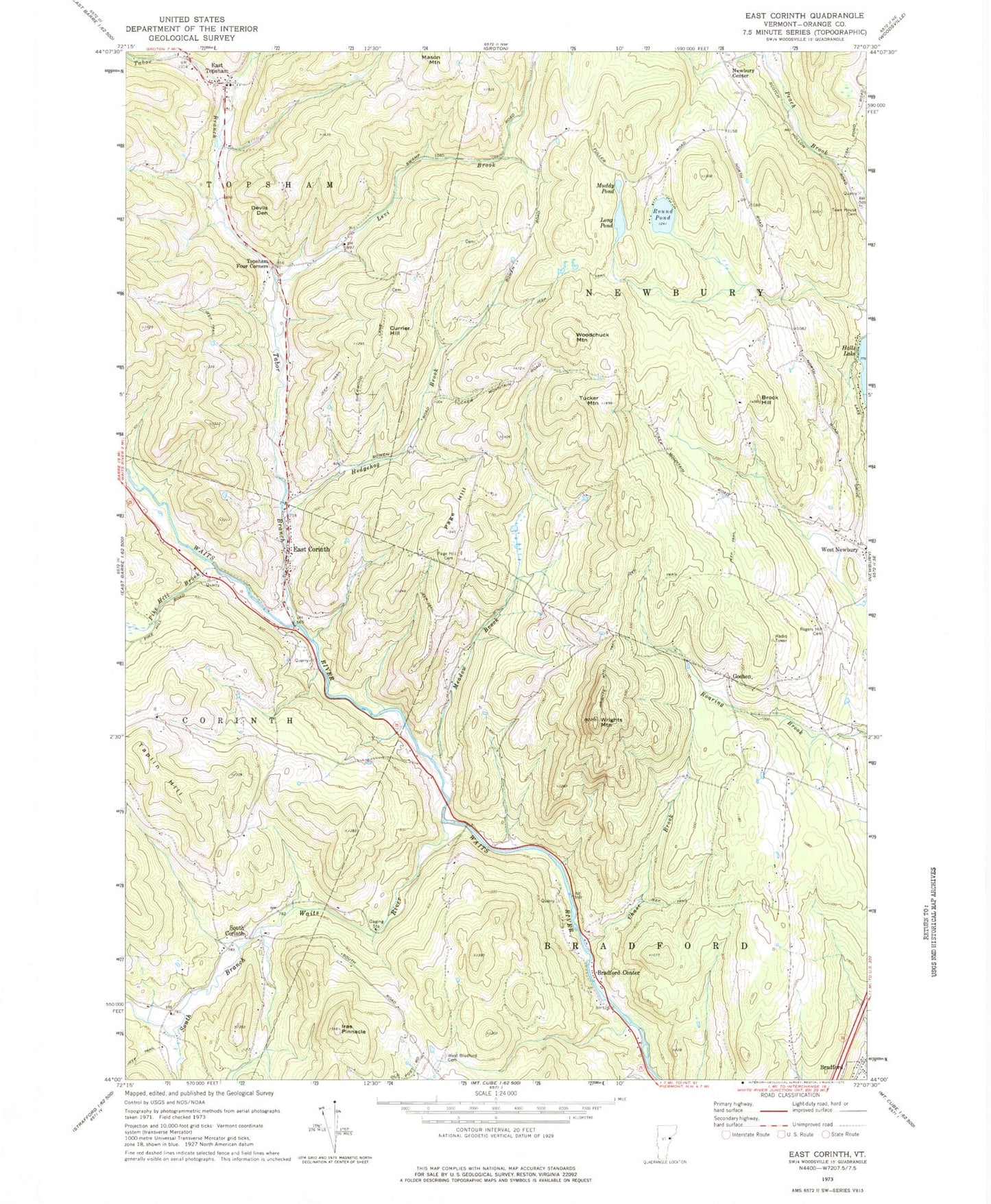
Classic USGS East Corinth Vermont 7.5'x7.5' Topo Map
Couldn't load pickup availability
Historical USGS topographic quad map of East Corinth in the state of Vermont. Typical map scale is 1:24,000, but may vary for certain years, if available. Print size: 24" x 27"
This quadrangle is in the following counties: Orange.
The map contains contour lines, roads, rivers, towns, and lakes. Printed on high-quality waterproof paper with UV fade-resistant inks, and shipped rolled.
Contains the following named places: Bradford Center, Brock Hill, Chase Brook, Currier Hill, Devils Den, East Corinth, East Topsham, Goshen, Hedgehog Brook, Iras Pinnacle, Levi Brook, Long Pond, Meadow Brook, Muddy Pond, Page Hill, Page Hill Cemetery, Pike Hill Brook, Rogers Hill Cemetery, Round Pond, South Branch Waits River, South Corinth, Tabor Branch, Taplin Hill, Topsham Four Corners, Town House Cemetery, Tucker Mountain, West Bradford Cemetery, Woodchuck Mountain, Wrights Mountain, Wrights Mountain Trail, Newbury Center, Town of Bradford, Halls Lake Dam, Halls Lake, Avery Family Cemetery, Blake Memorial Library, Brock Hill School (historical), Currier Hill Cemetery, East Corinth Old Cemetery, East Corinth New Cemetery, East Corinth Post Office, East Topsham Cemetery, Goshen Cemetery, Goshen Church, Goshen School (historical), Mills Family Cemetery, Munn-Rowell Cemetery, Renfrow - Heath Cemetery, South Corinth School (historical), Taplin Hill School (historical), Tucker Mountain - Putnam Cemetery, West Bradford School (historical), West Newbury Village Historic District, Wrights Mountain Cemetery, East Corinth Volunteer Fire Department, Tri - Village Fire Department