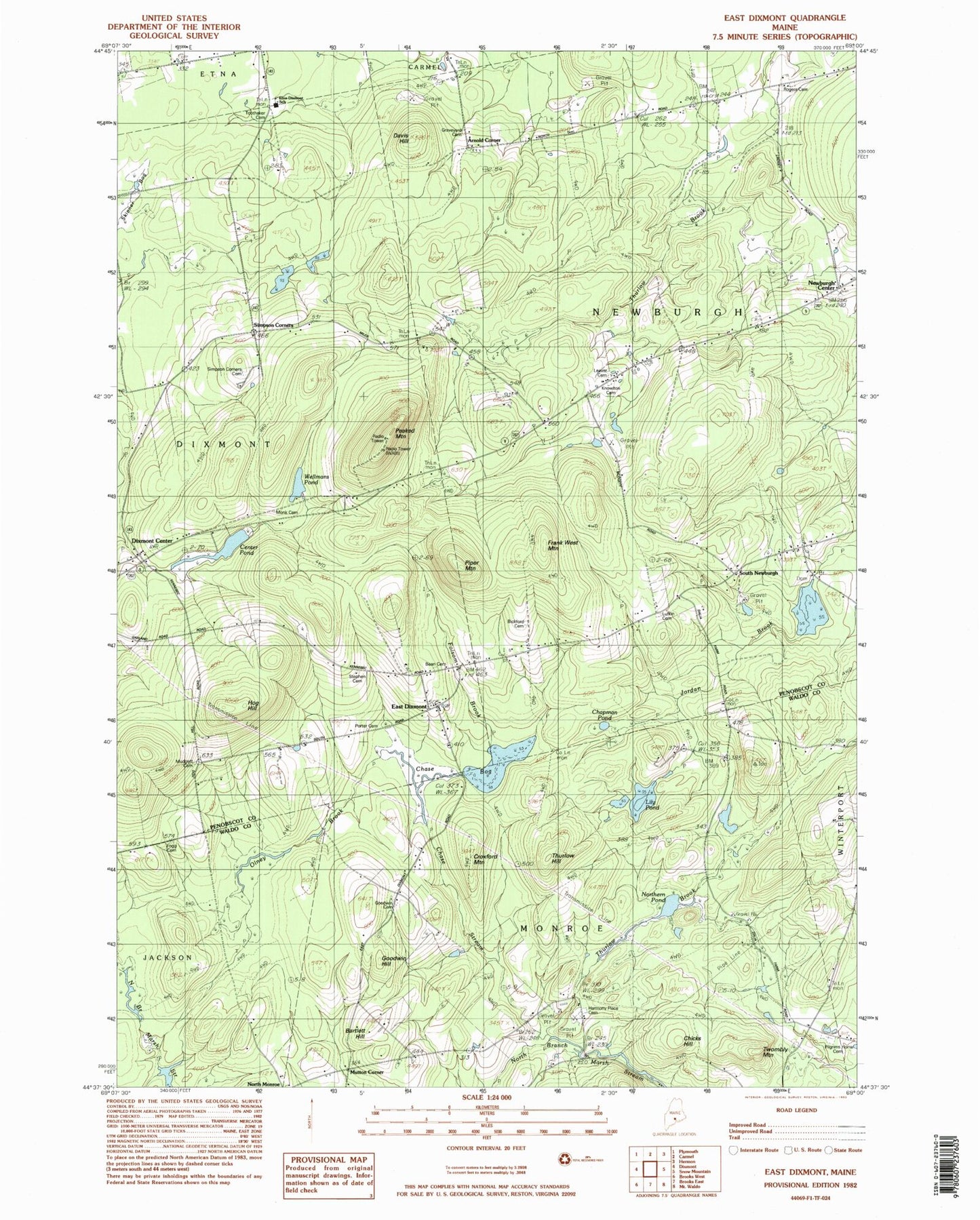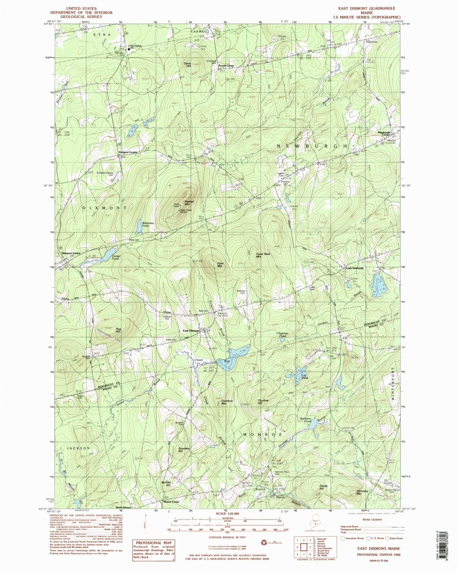
MyTopo
Classic USGS East Dixmont Maine 7.5'x7.5' Topo Map
Couldn't load pickup availability
Historical USGS topographic quad map of East Dixmont in the state of Maine. Map scale may vary for some years, but is generally around 1:24,000. Print size is approximately 24" x 27"
This quadrangle is in the following counties: Penobscot, Waldo.
The map contains contour lines, roads, rivers, towns, and lakes. Printed on high-quality waterproof paper with UV fade-resistant inks, and shipped rolled.
Contains the following named places: Arnold Corner, Arnolds Corner Cemetery, Bartlett Hill, Bean Cemetery, Bell School, Bickford Cemetery, Center Pond, Chapman Pond, Chase Bog, Chase Stream, Chicks Hill, Community Ambulance Service, Croxford Mountain, Davis Hill, Dixmont Center, Dixmont Volunteer East Dixmont Fire Station, East Dixmont, Etna Dixmont School, Fogg Cemetery, Folsom Brook, Frank West Mountain, Gilmore Meadows, Goodwin Hill, Harmony Place Cemetery, Hill Cemetery, Hill School, Hog Hill, Ide Hill, Jordan Brook, Knowlton Cemetery, Knowlton School, Leavitt Cemetery, Lily Pond, Monk Cemetery, Mudgett Cemetery, Newburgh Center, Newburgh Volunteer Fire Station, Northern Pond, Olney Brook, Peaked Mountain, Piper Mountain, Porter Cemetery, Ribgy Cemetery, Simpson Corners, Simpson Corners Cemetery, South Newburgh, Stevens Cemetery, Thurlow Brook, Thurlow Hill, Toothaker Cemetery, Town of Newburgh, Twombly Mountain, WABI-TV (Bangor), WAEI-FM, Wellmans Pond, York Ponds