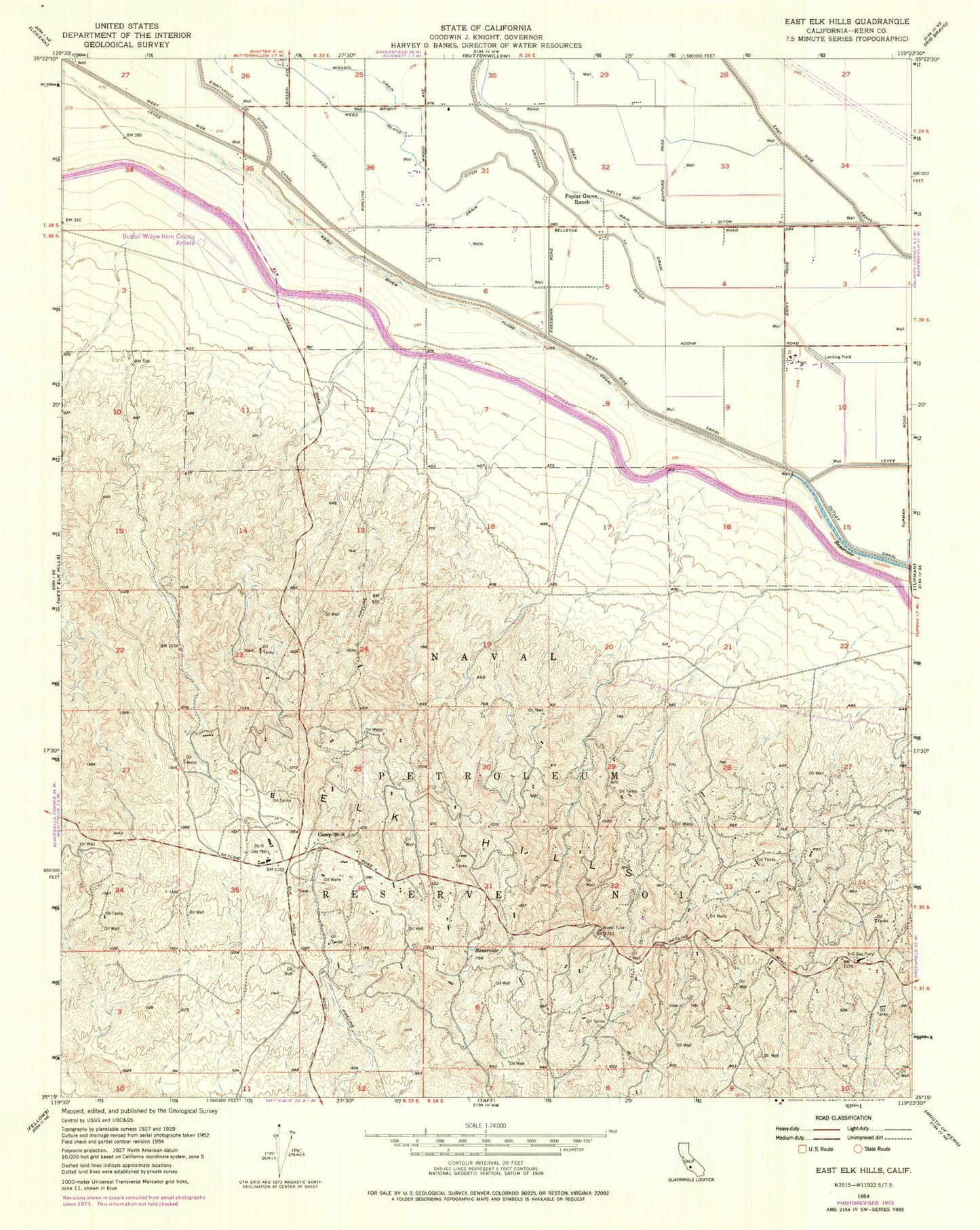
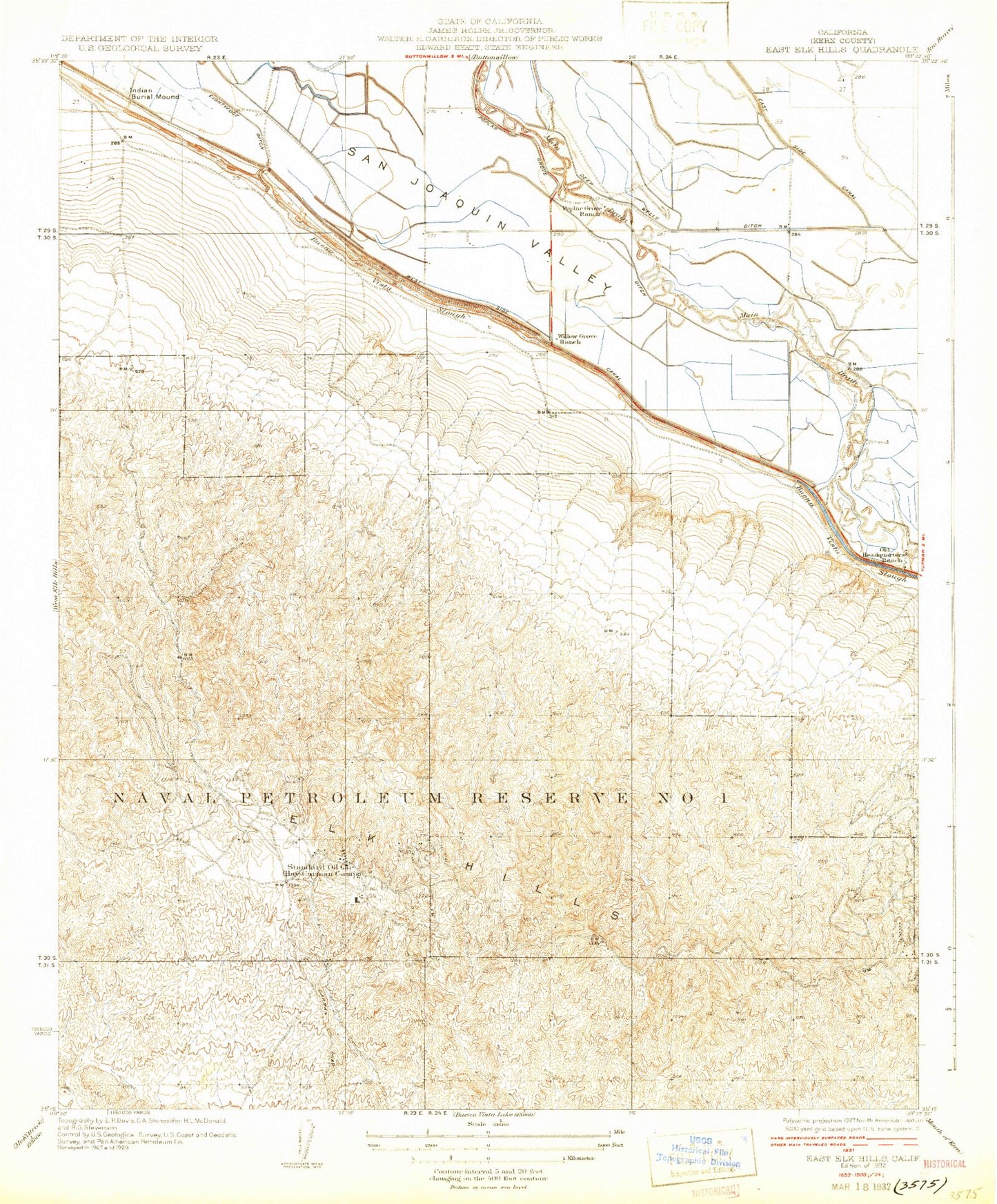
MyTopo
Classic USGS East Elk Hills California 7.5'x7.5' Topo Map
Regular price
$16.95
Regular price
Sale price
$16.95
Unit price
per
Couldn't load pickup availability
Historical USGS topographic quad map of East Elk Hills in the state of California. Map scale may vary for some years, but is generally around 1:24,000. Print size is approximately 24" x 27"
This quadrangle is in the following counties: Kern.
The map contains contour lines, roads, rivers, towns, and lakes. Printed on high-quality waterproof paper with UV fade-resistant inks, and shipped rolled.
Contains the following named places: Arizona Ditch, Camp Thirty Six-R, Deep Wells Ditch, Elk Hills-Buttonwillow Airport, Florida Drain, Mirasol Drain, Old Headquarters Ranch, Poplar Grove Ranch, Thirty Five-R Gas Plant, Three-G Gas Plant, Weed Island Ditch, Willow Grove Ranch