
MyTopo
Classic USGS East Juliette Georgia 7.5'x7.5' Topo Map
Couldn't load pickup availability
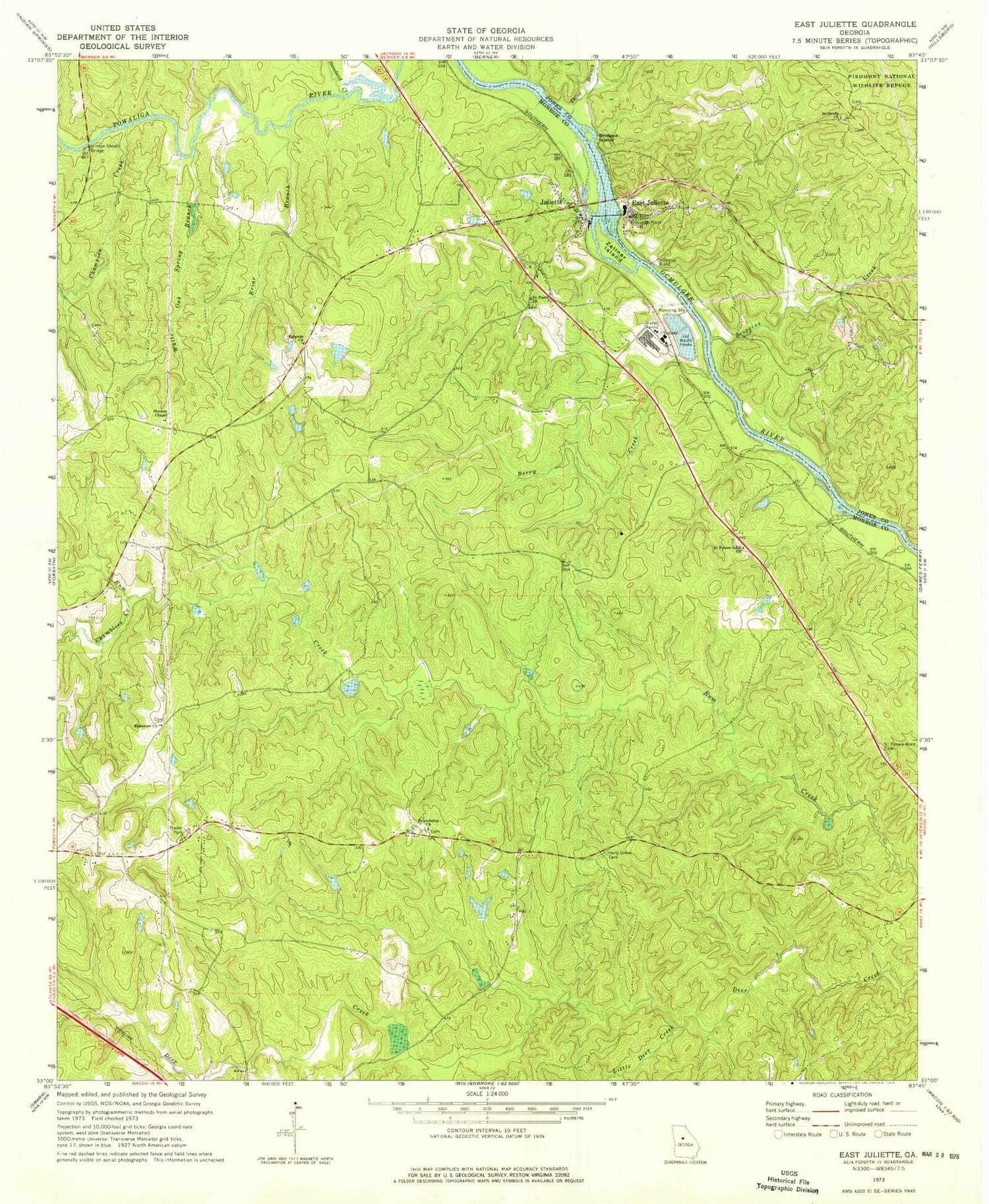
Historical USGS topographic quad map of East Juliette in the state of Georgia. Map scale may vary for some years, but is generally around 1:24,000. Print size is approximately 24" x 27"
This quadrangle is in the following counties: Jones, Monroe.
The map contains contour lines, roads, rivers, towns, and lakes. Printed on high-quality waterproof paper with UV fade-resistant inks, and shipped rolled.
Contains the following named places: Berry Creek, Bethesda Church, Briar Branch, Bridges Island, Browns Chapel, Chambliss Creek, Champion Creek, East Juliette, East Juliette Church, Ebenezer Cemetery, Ebenezer Church, Ephesus Church, Friendship Church, Glover Ferry, Hicks Lake, Hicks Lake Dam, Hinton Shoals Bridge, Holly Grove Cemetery, Holly Grove Primitive Baptist Church, Holly Grove School, Jerry Wadley Memorial Bridge, Juliette, Juliette Baptist Church, Juliette Census Designated Place, Juliette Junior High School, Juliette Post Office, Juliette School, Juliette United Methodist Church, Juliette United Methodist Church Cemetery, Little Deer Creek, Monroe County Fire Department Station 3, Newby - Mitchell Cemetery, Percale, Rum Creek Wildlife Management Area, Saint Pauls Church, Saint Peters Rock Cemetery, Saint Peters Rock Church, Scoggins Creek, Spring Hill Baptist Church, Standard Creek, Third Branch, Walker School, White Oak Spring Branch, Williams Lake, Williams Lake Dam, Zellner Island, ZIP Code: 31046


