
MyTopo
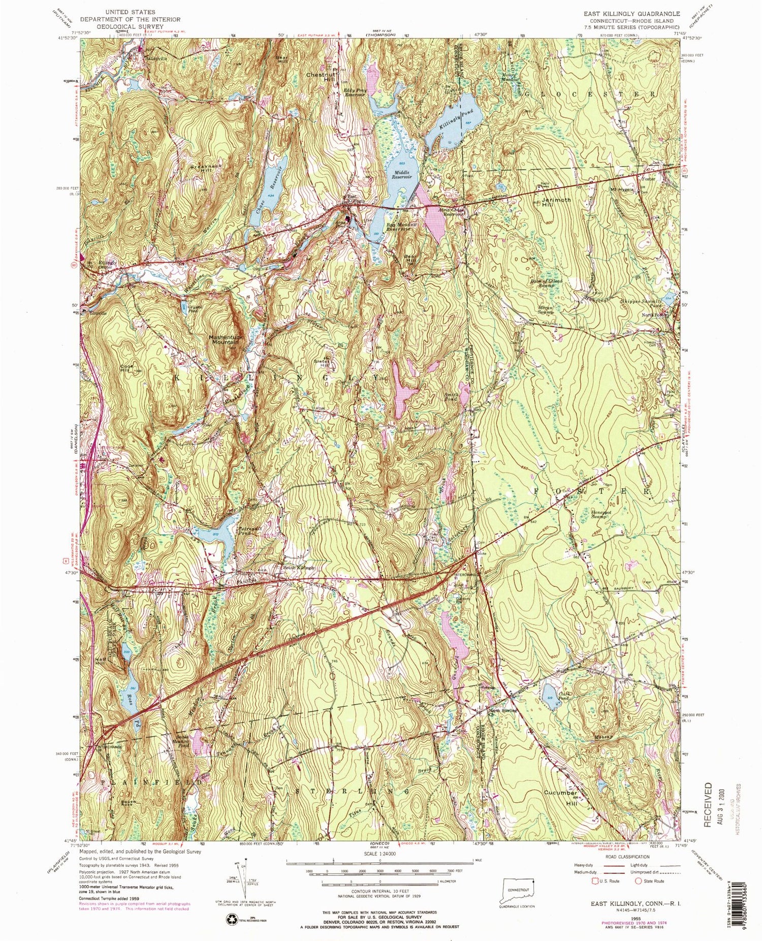
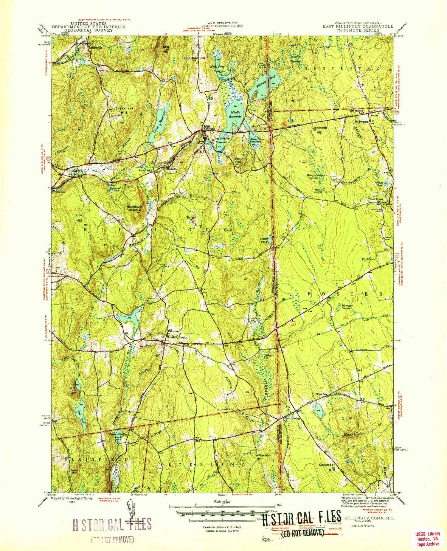
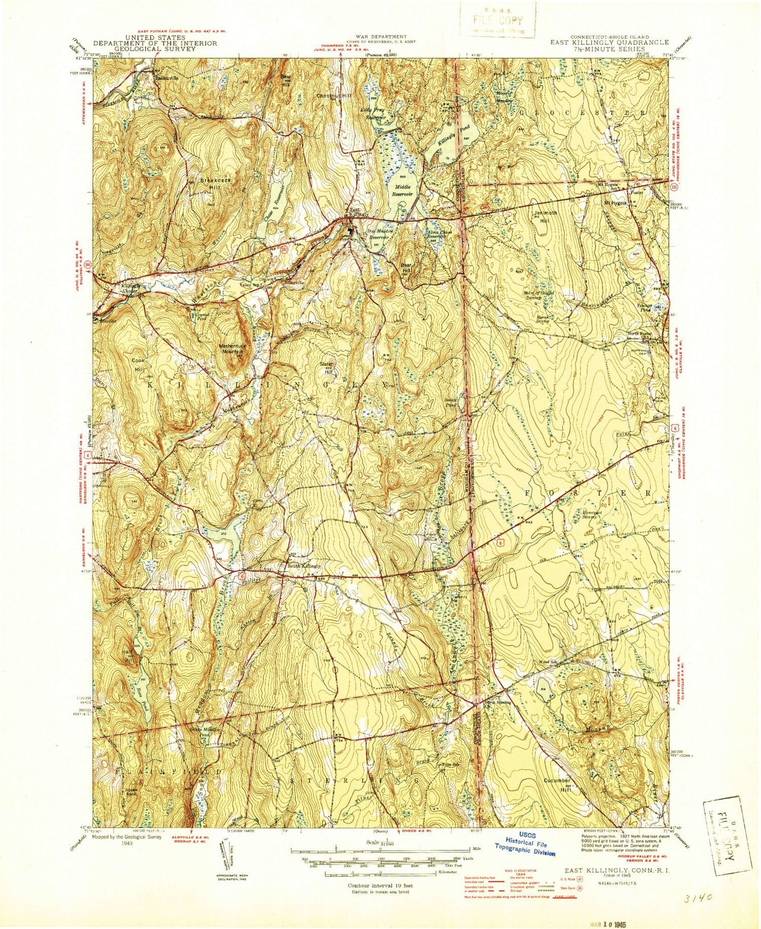
Classic USGS East Killingly Connecticut 7.5'x7.5' Topo Map
Couldn't load pickup availability
Historical USGS topographic quad map of East Killingly in the states of Connecticut, Massachusetts, Rhode Island. Typical map scale is 1:24,000, but may vary for certain years, if available. Print size: 24" x 27"
This quadrangle is in the following counties: Providence, Windham.
The map contains contour lines, roads, rivers, towns, and lakes. Printed on high-quality waterproof paper with UV fade-resistant inks, and shipped rolled.
Contains the following named places: Acme Pond, Alvia Chase Reservoir, Bear Hill, Bear Hill, Bog Meadow Reservoir, Breakneck Hill, Chase Reservoir, Chestnut Hill, Cook Hill, Crystal Pond, East Killingly, Eddy Pray Reservoir, Fiske Cemetery, Half Hill, Half Hill Brook, Killingly Center, Killingly Pond, Mashentuck Brook, Mashentuck Mountain, Middle Reservoir, Norton Brook, Old Furnace State Park, Phillips Brook, Ross Pond, Rounds Brook, Salisbury Brook, Slater Brook, Slater Hill, Smith Pond, Snake Meadow Pond, South Killingly, Squaw Rock, Tennant Brook, Tetreault Pond, Titus Brook, Warren Brook, Yankee Airstrip, Town of Killingly, Killingly Pond, Whetstone Brook Reservoir, Crystal Pond Dam, Whetstone Brook Dam, Whetstone Brook Reservoir, Lake Albert Dam, Lake Albert, Acme Pond Dam, Killingly Pond Dam, Lower Ross Pond Dam, Lower Ross Pond, Chase Reservoir Dam, Tetreault Pond Dam, Eddy Pray Reservoir Dam, Snake Meadow Pond Dam, Smith Pond Dam, Furnace Pond Dam, Furnace Pond, Ross Management Area Pond Dam, Ross Management Area Pond, Talcott Reservoir Dike Number 2, Acquidaneck (historical), Alva Pond Hill, Ballouville Post Office, Brainard Cemetery, Church of the Living God, Colonial Baptist Church, East Killingly Fire Department Station 64, East Killingly Post Office, Elliotville (historical), Elliotville Lower Mill (historical), Killingly Pond State Park Reserve, Line Baptist Church, South Killingly Cemetery, Old Chestnut Hill Cemetery, Old South Killingly Cemetery, Saint Annes Church, South Killingly Congregational Church, Squaw Rock State Park, Titus School (historical), Union Baptist Church, Valley School, South Killingly Fire Department Station 65, Killingly - Brooklyn Ambulance Corps, Obed Fuller Lot Cemetery, Seekonk Intermediate School, Tremont Pond, Cucumber Hill, Clark Pond, Honeypot Swamp, North Foster, Moran Swamp, Shippee Sawmill Pond, Huntington Brook, Balm of Gilead Swamp, Mount Hygeia, Mowry Meadow, Foster, Jerimoth Hill, Cooke Store (historical), Hopkins Lot Cemetery, Hopkins - Young Lot Cemetery, North Foster Baptist Church, Jones - Hammon Lot, John Brown Lot, Olney Goodspeed Lot, Robert Shippee Lot Cemetery, Daniel Salsbury Lot, Elijah Paine Lot, Nathaniel Bennett Lot, Captain Nathaniel Harrington Lot, Jonathan Tewgood Lot, Levi Randall Lot, Burgess - Round Lot, Deacon Augustus Sweet Lot Cemetery, Colwell - Hopkins Lot, Captain Isaac Paine Lot, Obadiah Easten Lot, Titus - Baker Lot, Kimball Burgess Lot, The Line Cemetery, Turner - Cooke Lot, Harrington Lot, Dr Solomon Drowne Lot, Gideon Burgess Lot Cemetery, Reverend Charles Wade Lot, Anthony Clemmons Lot, Alonzo Shippee Lot, Acme Pond, Alvia Chase Reservoir, Bear Hill, Bear Hill, Bog Meadow Reservoir, Breakneck Hill, Chase Reservoir, Chestnut Hill, Cook Hill, Crystal Pond, East Killingly, Eddy Pray Reservoir, Fiske Cemetery, Half Hill, Half Hill Brook, Killingly Center, Killingly Pond, Mashentuck Brook, Mashentuck Mountain, Middle Reservoir, Norton Brook, Old Furnace State Park, Phillips Brook, Ross Pond, Rounds Brook, Salisbury Brook, Slater Brook, Slater Hill, Smith Pond, Snake Meadow Pond, South Killingly, Squaw Rock, Tennant Brook, Tetreault Pond, Titus Brook, Warren Brook, Yankee Airstrip, Town of Killingly, Killingly Pond, Whetstone Brook Reservoir, Crystal Pond Dam, Whetstone Brook Dam, Whetstone Brook Reservoir, Lake Albert Dam, Lake Albert, Acme Pond Dam, Killingly Pond Dam, Lower Ross Pond Dam, Lower Ross Pond, Chase Reservoir Dam, Tetreault Pond Dam, Eddy Pray Reservoir Dam, Snake Meadow Pond Dam, Smith Pond Dam, Furnace Pond Dam, Furnace Pond, Ross Management Area Pond Dam, Ross Management Area Pond, Talcott Reservoir Dike Number 2, Acquidaneck (historical), Alva Pond Hill, Ballouville Post Office, Brainard Cemetery, Church of the Living God, Colonial Baptist Church, East Killingly Fire Department Station 64, East Killingly Post Office, Elliotville (historical), Elliotville Lower Mill (historical), Killingly Pond State Park Reserve, Line Baptist Church, South Killingly Cemetery, Old Chestnut Hill Cemetery, Old South Killingly Cemetery, Saint Annes Church, South Killingly Congregational Church, Squaw Rock State Park, Titus School (historical), Union Baptist Church, Valley School, South Killingly Fire Department Station 65, Killingly - Brooklyn Ambulance Corps, Obed Fuller Lot Cemetery, Seekonk Intermediate School, Tremont Pond, Cucumber Hill, Clark Pond, Honeypot Swamp, North Foster, Moran Swamp, Shippee Sawmill Pond, Huntington Brook, Balm of Gilead Swamp, Mount Hygeia, Mowry Meadow, Foster, Jerimoth Hill, Cooke Store (historical), Hopkins Lot Cemetery, Hopkins - Young Lot Cemetery, North Foster Baptist Church, Jones - Hammon Lot, John Brown Lot, Olney Goodspeed Lot, Robert Shippee Lot Cemetery, Daniel Salsbury Lot, Elijah Paine Lot, Nathaniel Bennett Lot, Captain Nathaniel Harrington Lot, Jonathan Tewgood Lot


