
MyTopo
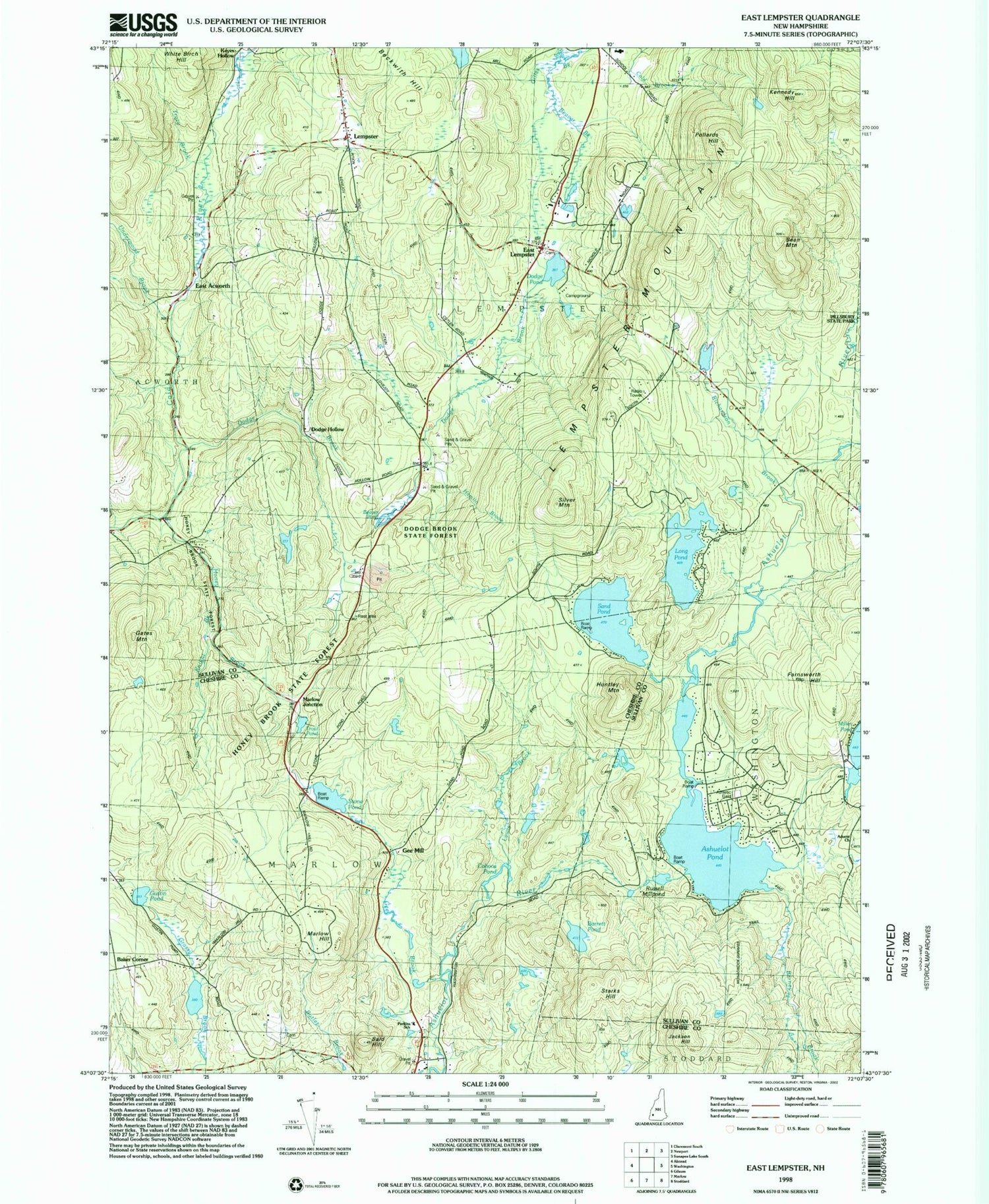
Classic USGS East Lempster New Hampshire 7.5'x7.5' Topo Map
Couldn't load pickup availability
Historical USGS topographic quad map of East Lempster in the state of New Hampshire. Typical map scale is 1:24,000, but may vary for certain years, if available. Print size: 24" x 27"
This quadrangle is in the following counties: Cheshire, Sullivan.
The map contains contour lines, roads, rivers, towns, and lakes. Printed on high-quality waterproof paper with UV fade-resistant inks, and shipped rolled.
Contains the following named places: Advent Church, Ashuelot Pond, Bald Hill, Barrett Pond, Bean Mountain, Beaver Brook, Beaver Pond, Beckwith Hill, Cohoos Pond, Dodge Brook, Dodge Brook State Forest, Dodge Hollow, Dodge Pond, East Acworth, East Lempster, Farnsworth Hill, Gates Mountain, Gee Brook, Goshen Lampster School, Gustin Pond, Hamlin Brook, Honey Brook, Honey Brook State Forest, Huntley Mountain, Jackson Hill, Kennedy Hill, Knight Brook, Lempster, Lempster Mountain, Lewis Brook, Long Pond, Marlow Hill, Marlow Junction, Pollards Hill, Richardson Brook, Russell Millpond, Sand Pond, Silver Mountain, Starks Hill, Stone Pond, Symonds Pond, Tracy Brook, Trout Pond, Underwood Brook, Ways Brook, Baker Corner, Gee Mill, Town of Lempster, Town of Marlow, Millen Lake Dam, Millen Lake, Ashuelot Pond Dam, Long Pond Dam, Richardson Brook Dam, Richardson Brook Pond, Sand Pond Dam, Sand Pond, Lempster Post Office, Marlow Post Office, Goshen - Lempster Cooperative School, Miner Memorial Chapel, John D Perkins Elementary School, Barney Brook, Parkins School, Lempster Fire Department, Lempster Rescue


