MyTopo
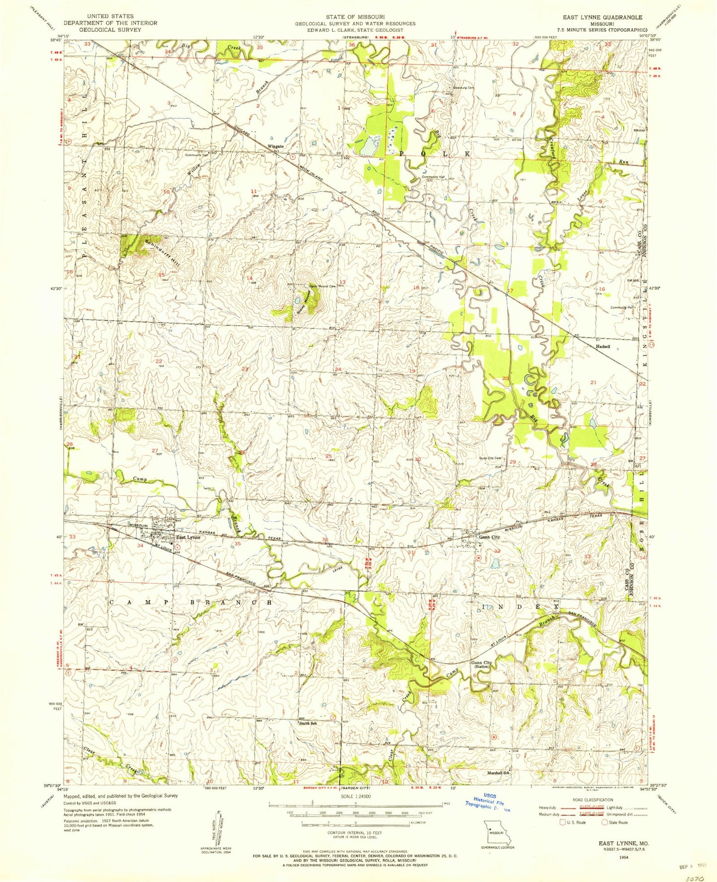
Classic USGS East Lynne Missouri 7.5'x7.5' Topo Map
Couldn't load pickup availability
Historical USGS topographic quad map of East Lynne in the state of Missouri. Map scale may vary for some years, but is generally around 1:24,000. Print size is approximately 24" x 27"
This quadrangle is in the following counties: Cass, Johnson.
The map contains contour lines, roads, rivers, towns, and lakes. Printed on high-quality waterproof paper with UV fade-resistant inks, and shipped rolled.
Contains the following named places: Cause Prairie, City of East Lynne, Clear Creek, Crawford Creek, Daugherty School, East Lynne, East Lynne Elementary School, East Lynne Post Office, German Town School, Gunn City, Gunn City Cemetery, Gunn City Fire Department, Gunn City School, Hadsell, Hapke Lake, Hapke Lake Dam, Hereford Lake, Hereford Lake Dam, Jim Kircher Dam, Kircher Lake, Kircher P D Dam, Kirchers Upper Lake, Louse Run, Marshall School, Meher Lake, Mehrer Lake Dam, Oviet, Roth Farms Airport, Roth Farms Lake Dam, Roth Lake, Roth Lake Dam, Schindorff Hill, Schrock Lake Dam, Shingleton Lake, Shingleton Lake Dam, Smith School, Staley Mound, Staley Mound Cemetery, Strasburg Cemetery, Township of Camp Branch, Village of Gunn City, Willow Branch, Wingate, Wingate School, Young Lake, Young Lake Dam, ZIP Code: 64743