
MyTopo
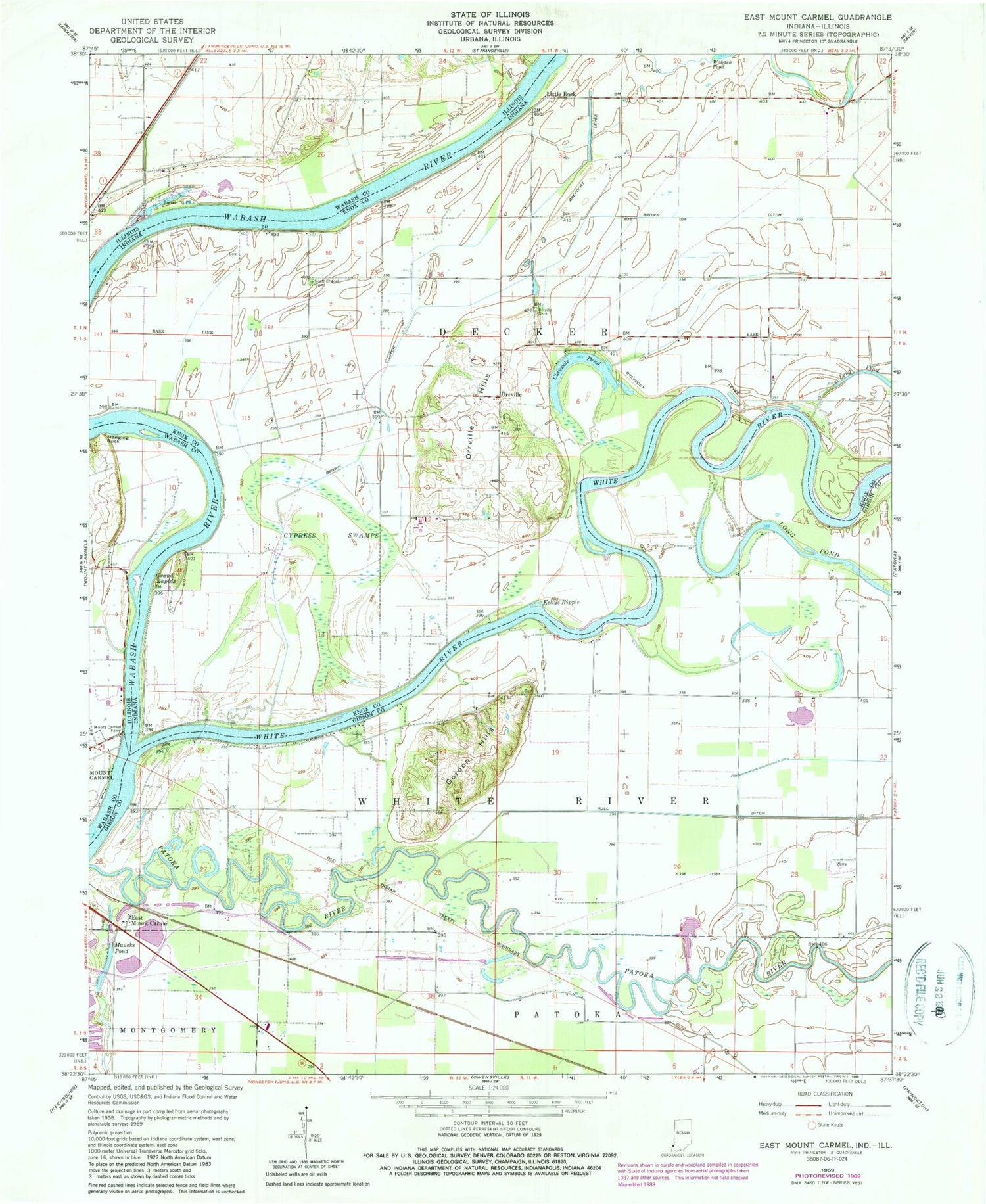
Classic USGS East Mount Carmel Indiana 7.5'x7.5' Topo Map
Couldn't load pickup availability
Historical USGS topographic quad map of East Mount Carmel in the states of Indiana, Illinois. Map scale may vary for some years, but is generally around 1:24,000. Print size is approximately 24" x 27"
This quadrangle is in the following counties: Gibson, Knox, Wabash.
The map contains contour lines, roads, rivers, towns, and lakes. Printed on high-quality waterproof paper with UV fade-resistant inks, and shipped rolled.
Contains the following named places: Claypole Pond, Cypress Swamps, East Mount Carmel, Eickholtz Airport, Gordon Hills, Grand Rapids, Hanging Rock, Hull Ditch, Kellys Ripple, Little Rock, Long Pond, Maucks Pond, Mount Carmel Ferry, Orrville, Orrville Cemetery, Orrville Hills, Pohaten, Scott Chapel Cemetery, Selma, Township of Decker, White River


