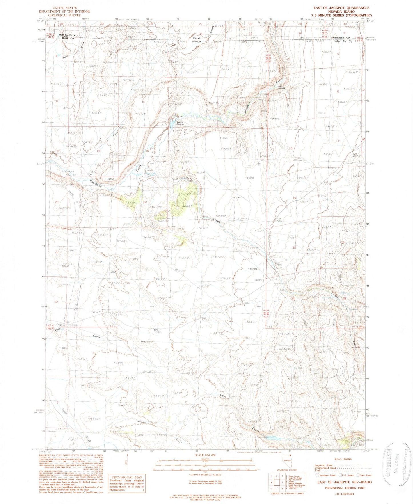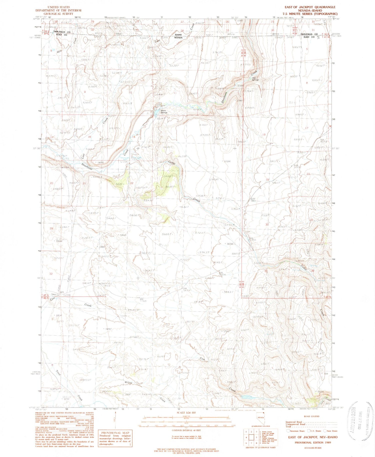
MyTopo
Classic USGS East of Jackpot Nevada 7.5'x7.5' Topo Map
Regular price
$16.95
Regular price
Sale price
$16.95
Unit price
per
Couldn't load pickup availability
Historical USGS topographic quad map of East of Jackpot in the states of Nevada, Idaho. Map scale may vary for some years, but is generally around 1:24,000. Print size is approximately 24" x 27"
This quadrangle is in the following counties: Elko, Twin Falls.
The map contains contour lines, roads, rivers, towns, and lakes. Printed on high-quality waterproof paper with UV fade-resistant inks, and shipped rolled.
Contains the following named places: Bridge Ranch, Cedar Creek, Deer Springs, Hale Spring, Lost Canyon, Lost Creek, Nevada Noname Four Dam, Nevada Noname Three Dam, Warm Springs, Willow Creek