MyTopo
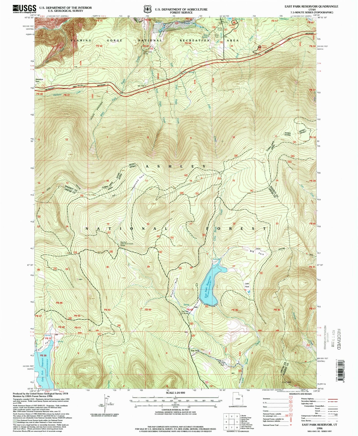
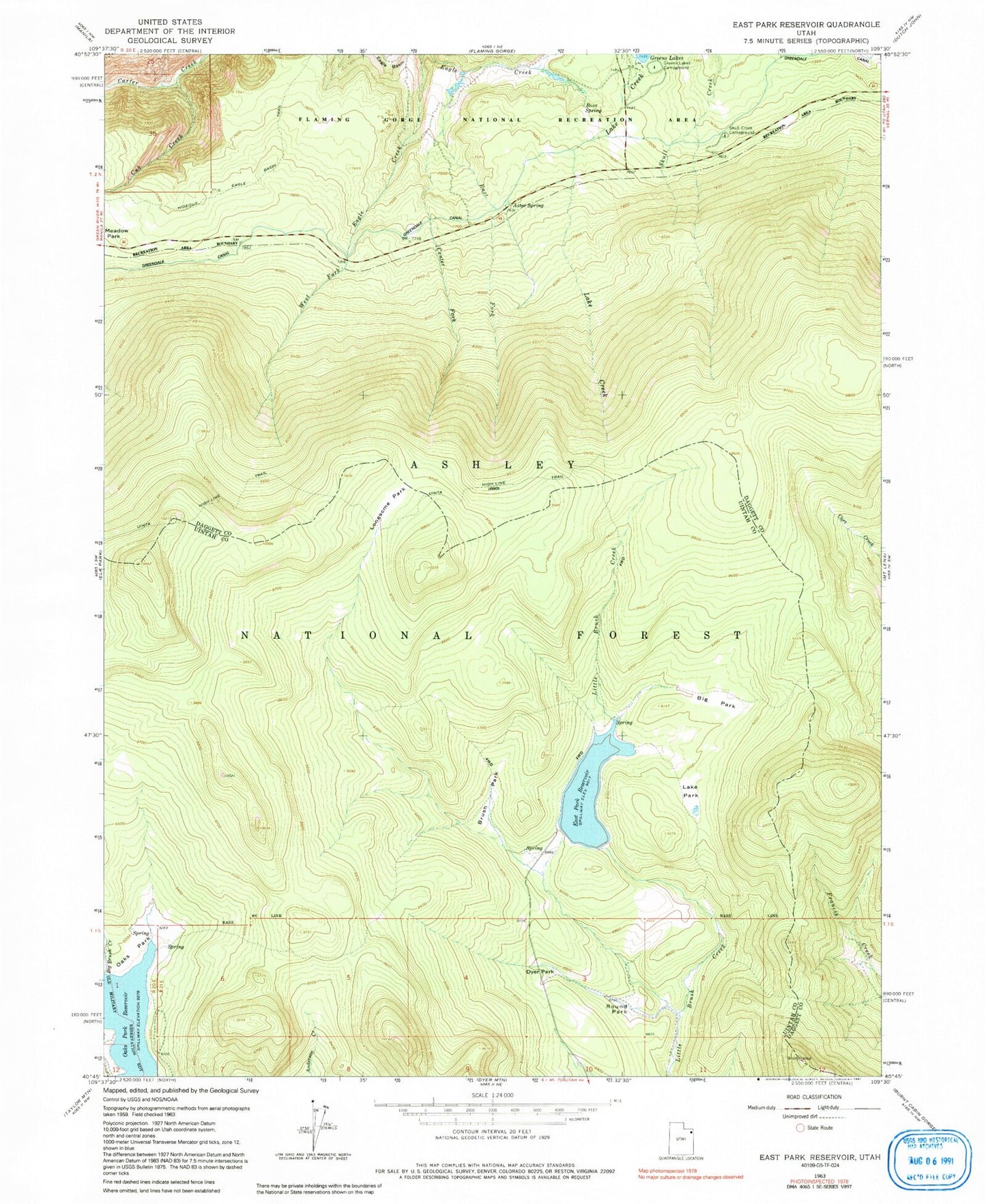
Classic USGS East Park Reservoir Utah 7.5'x7.5' Topo Map
Couldn't load pickup availability
Historical USGS topographic quad map of East Park Reservoir in the state of Utah. Typical map scale is 1:24,000, but may vary for certain years, if available. Print size: 24" x 27"
This quadrangle is in the following counties: Daggett, Uintah.
The map contains contour lines, roads, rivers, towns, and lakes. Printed on high-quality waterproof paper with UV fade-resistant inks, and shipped rolled.
Contains the following named places: Aztec Spring, Big Park, Brush Park, Center Fork Eagle Creek, Cub Creek, Dyer Park, East Fork Eagle Creek, Greens Lakes Campground, Lake Park, Lonesome Park, Meadow Park, Oaks Park Reservoir, Ross Spring, Round Park, Skull Creek Campground, East Park Reservoir, East Park Dam, East Park Campground, Lake Creek