
MyTopo
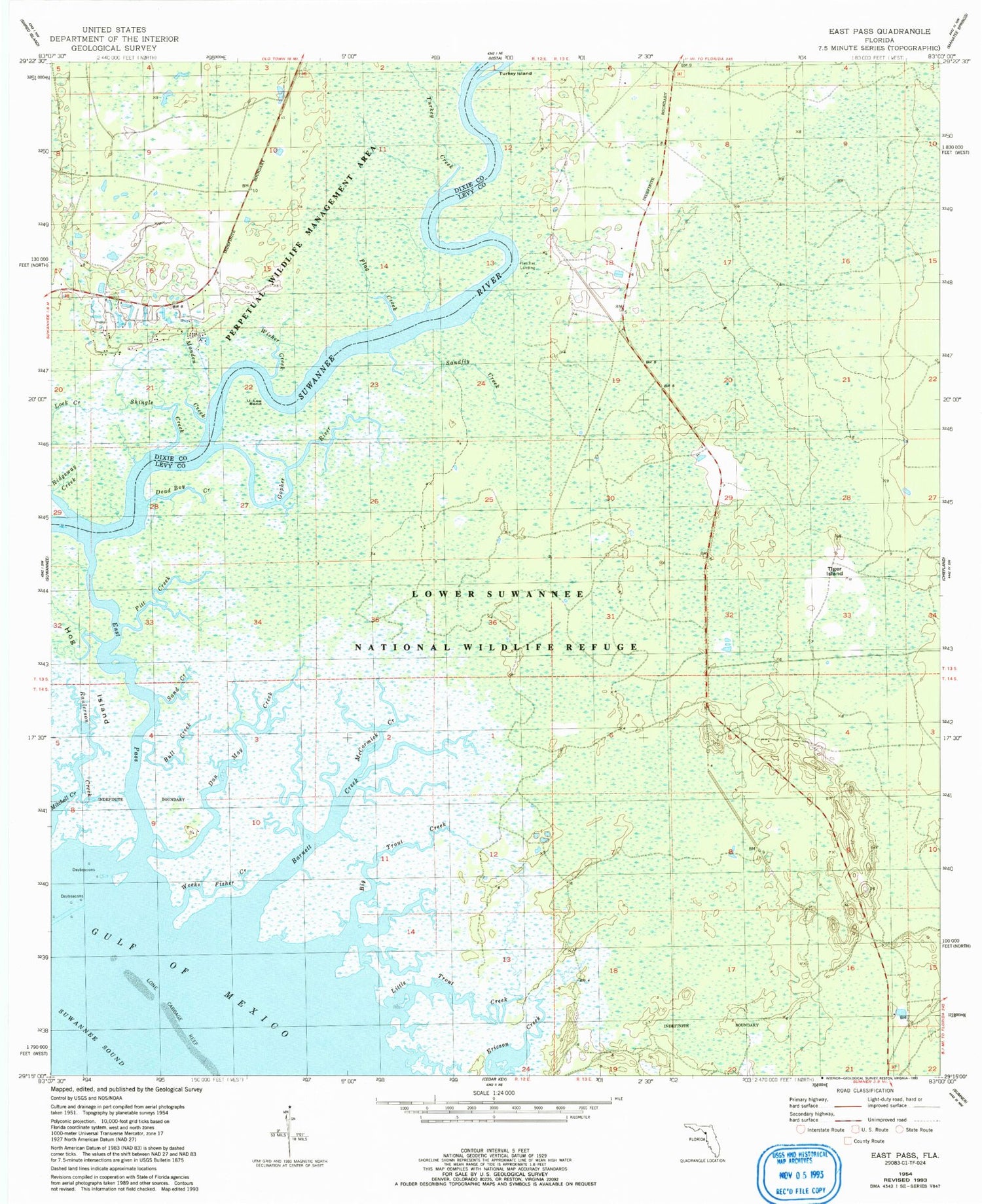
Classic USGS East Pass Florida 7.5'x7.5' Topo Map
Couldn't load pickup availability
Historical USGS topographic quad map of East Pass in the state of Florida. Typical map scale is 1:24,000, but may vary for certain years, if available. Print size: 24" x 27"
This quadrangle is in the following counties: Dixie, Levy.
The map contains contour lines, roads, rivers, towns, and lakes. Printed on high-quality waterproof paper with UV fade-resistant inks, and shipped rolled.
Contains the following named places: Barnett Creek, Big Trout Creek, Bull Creek, Dan May Creek, Dead Boy Creek, East Pass, Flag Creek, Gopher River, Little Trout Creek, McCormick Creek, Raulerson Creek, Monden Creek, Pitt Creek, Ridgeway Creek, Sand Creek, Sandfly Creek, Shingle Creek, Tiger Island, Turkey Creek, Turkey Island, Weeks Fisher Creek, Wisher Creek, Beech Creek (historical), Fletcher Landing, U-Lee Bend, Dixie County Fire and Rescue Station 71


