MyTopo
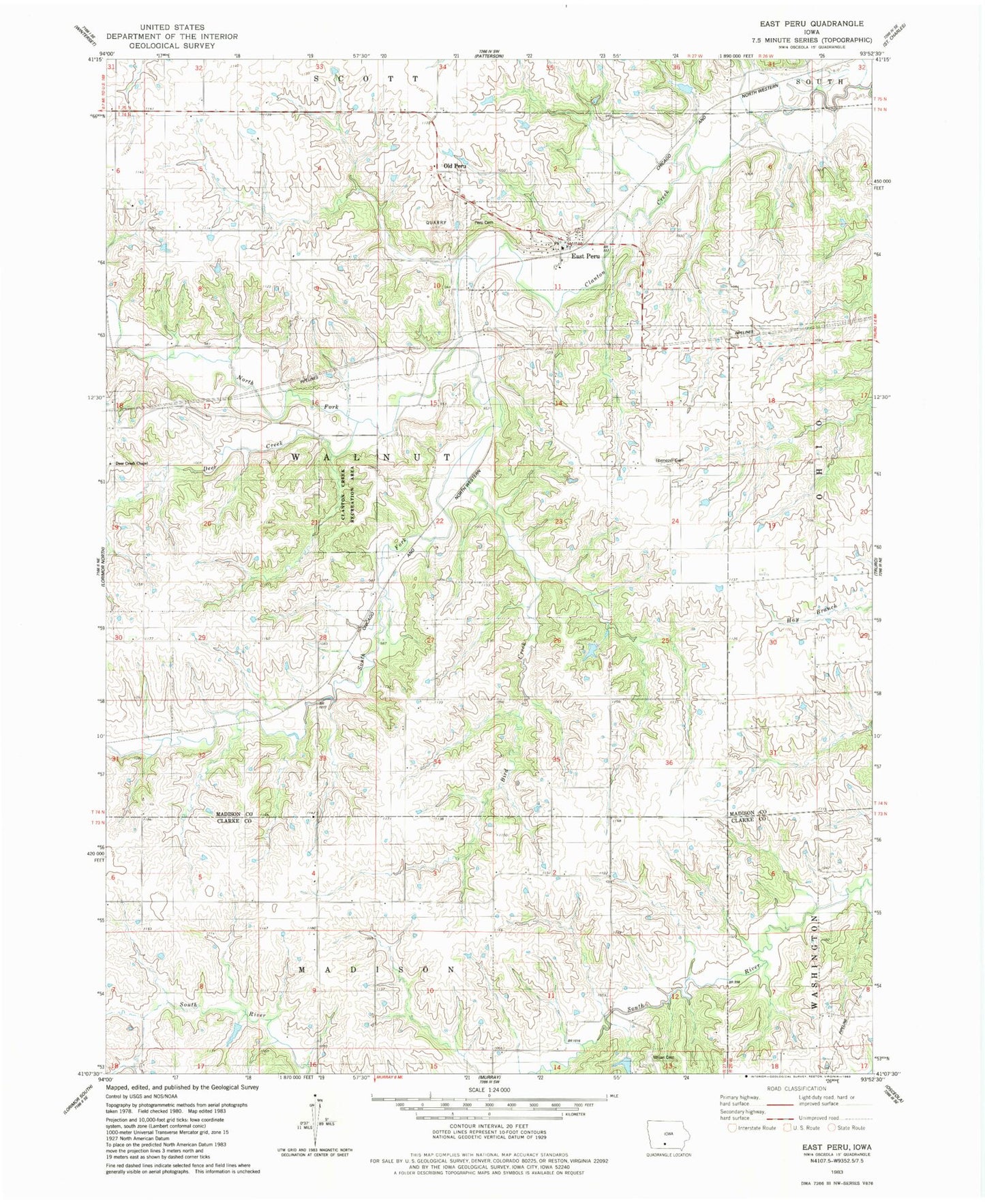
Classic USGS East Peru Iowa 7.5'x7.5' Topo Map
Couldn't load pickup availability
Historical USGS topographic quad map of East Peru in the state of Iowa. Map scale may vary for some years, but is generally around 1:24,000. Print size is approximately 24" x 27"
This quadrangle is in the following counties: Clarke, Madison.
The map contains contour lines, roads, rivers, towns, and lakes. Printed on high-quality waterproof paper with UV fade-resistant inks, and shipped rolled.
Contains the following named places: Bird Creek, Brooklyn Post Office, City of East Peru, Clanton Creek Recreation Area, Deer Creek, Deer Creek Chapel, East Peru, East Peru Post Office, East Peru Volunteer Fire Department, Ebenezer Cemetery, Foster Post Office, Laporte Post Office, Madison Chapel, Morgan Bridge, North Fork Clanton Creek, Ohio Post Office, Old Peru, Peru Cemetery, Peru Post Office, Peru United Methodist Church, Pleasant Ridge School, Prairie Grove School, South Fork Clanton Creek, Township of Walnut, Union Cemetery, Union Church, ZIP Code: 50222