
MyTopo
Classic USGS East Point Louisiana 7.5'x7.5' Topo Map
Couldn't load pickup availability
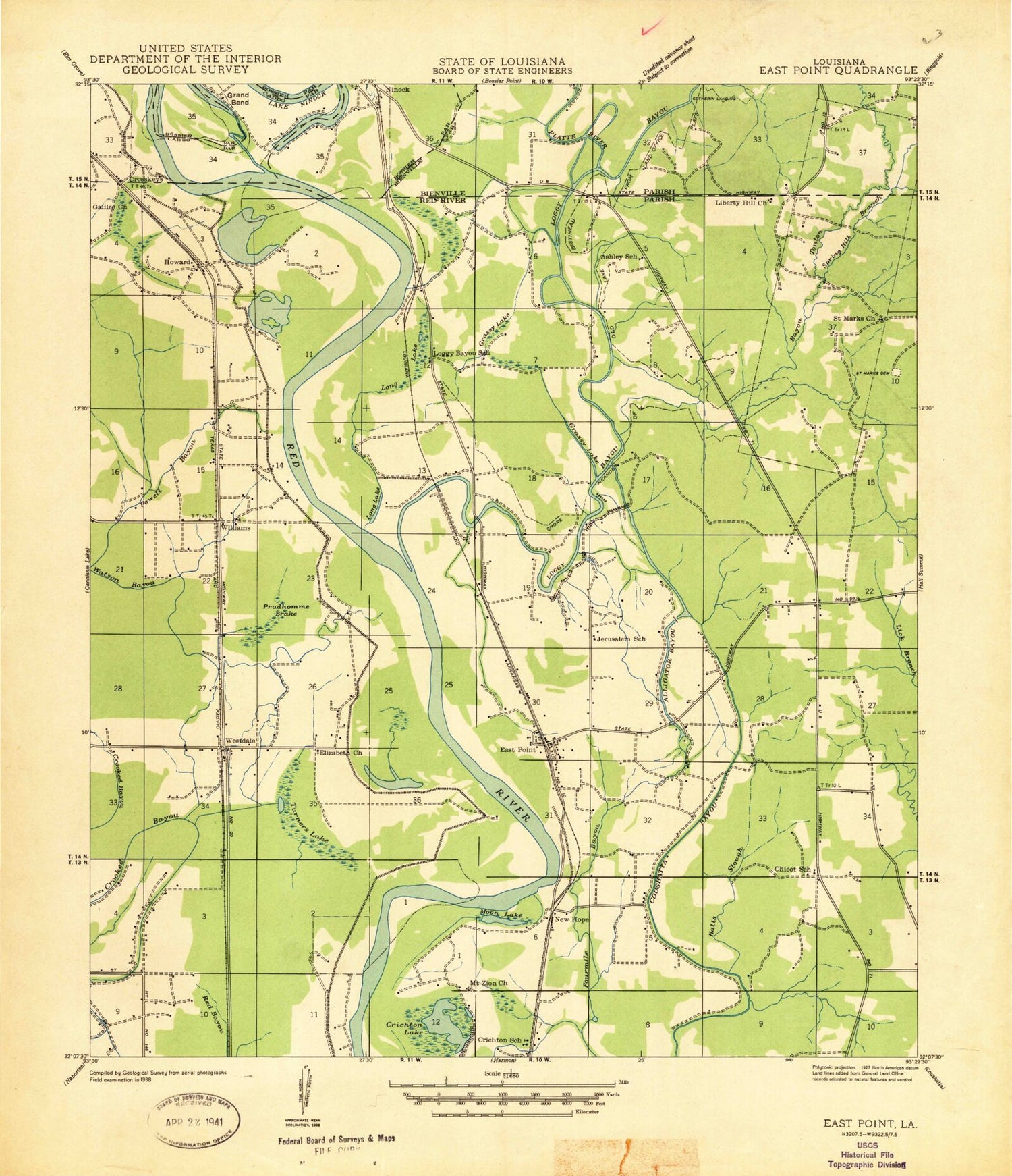
Historical USGS topographic quad map of East Point in the state of Louisiana. Map scale may vary for some years, but is generally around 1:24,000. Print size is approximately 24" x 27"
This quadrangle is in the following counties: Bienville, Bossier, Caddo, Red River.
The map contains contour lines, roads, rivers, towns, and lakes. Printed on high-quality waterproof paper with UV fade-resistant inks, and shipped rolled.
Contains the following named places: Alligator Bayou, Bayou Pierre, Coushatta Bayou, Crichton Lake, Crooked Bayou, Cross Roads, Crosskeys, Des Arc Oil Field, East Hope Gas Field, East Point, East Point Post Office, Elizabeth Church, Flat River, Fourmile Bayou, Grassy Lake, Grassy Lake Gas Field, Halls Slough, Howard, Liberty Hill Church, Loggy Bayou, Long Lake, New Era Church, New Hope, New Jerusalem Church, Ninock, Parish Governing Authority District 4, Powell Bayou, Prudhomme Lake, Riverdale Academy School, Saint John the Baptist Church, Saint Marks Cemetery, Saint Mary Church, Spring Hill Branch, Thomas Landing, Toulon Bayou, Toulon Bayou Gas Field, Toulon Bayou Number One Dam, True Vine Church, Turners Lake, Westdale, Williams, Williams Gas Field


