MyTopo
Classic USGS East Pryor Mountain Montana 7.5'x7.5' Topo Map
Regular price
$16.95
Regular price
Sale price
$16.95
Unit price
per
Couldn't load pickup availability
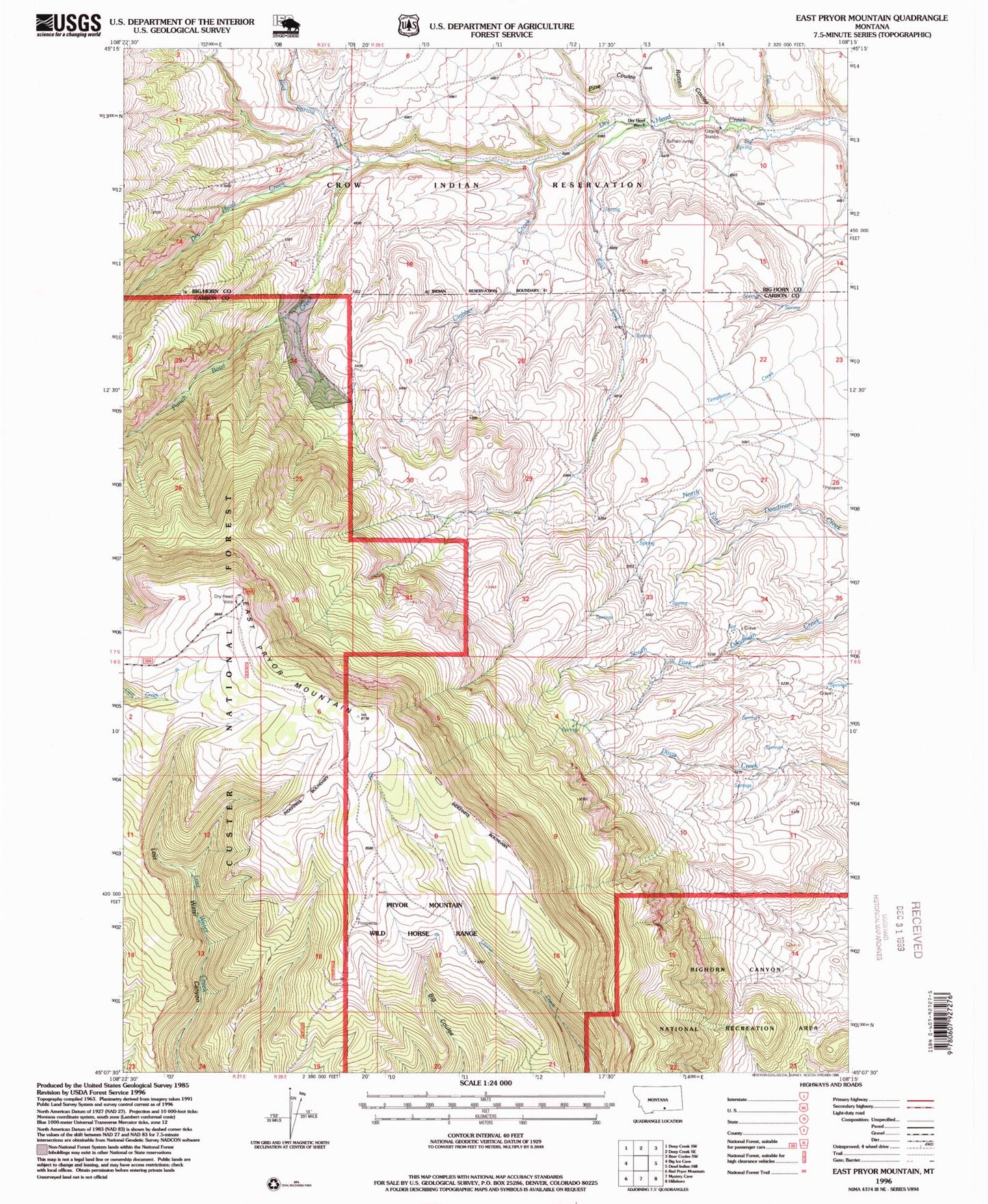
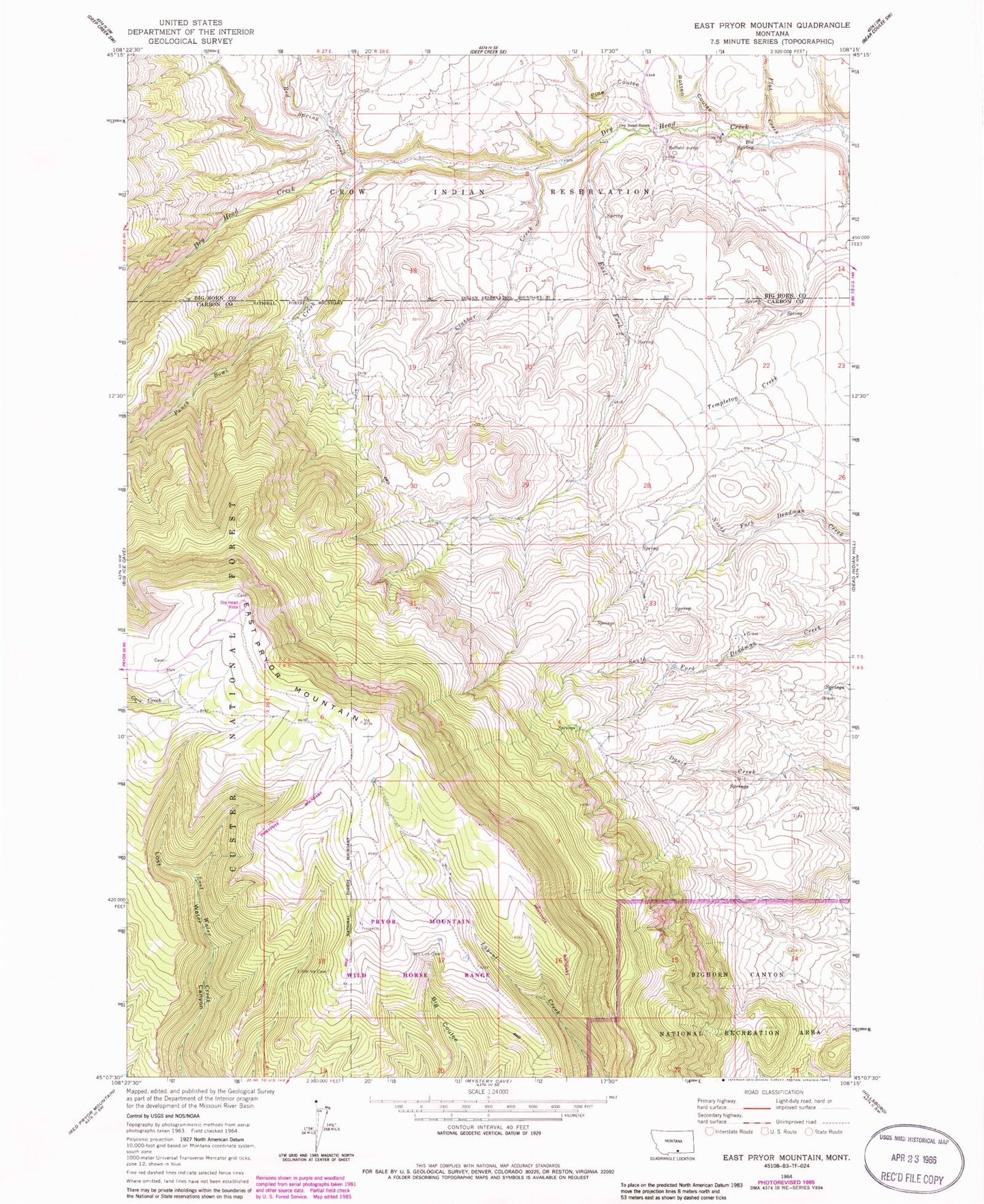
Historical USGS topographic quad map of East Pryor Mountain in the state of Montana. Map scale may vary for some years, but is generally around 1:24,000. Print size is approximately 24" x 27"
This quadrangle is in the following counties: Big Horn, Carbon.
The map contains contour lines, roads, rivers, towns, and lakes. Printed on high-quality waterproof paper with UV fade-resistant inks, and shipped rolled.
Contains the following named places: Big Spring, Buffalo Jump, Clabber Creek, Deadman Creek Grave, Dry Head Ranch, Dry Head Vista, Dryhead, Dryhead Post Office, East Fork Dryhead Creek, East Pryor Mountain, Flat Creek, Pine Coulee, Punch Bowl Creek, Red Spring Creek, Rotten Coulee