
MyTopo
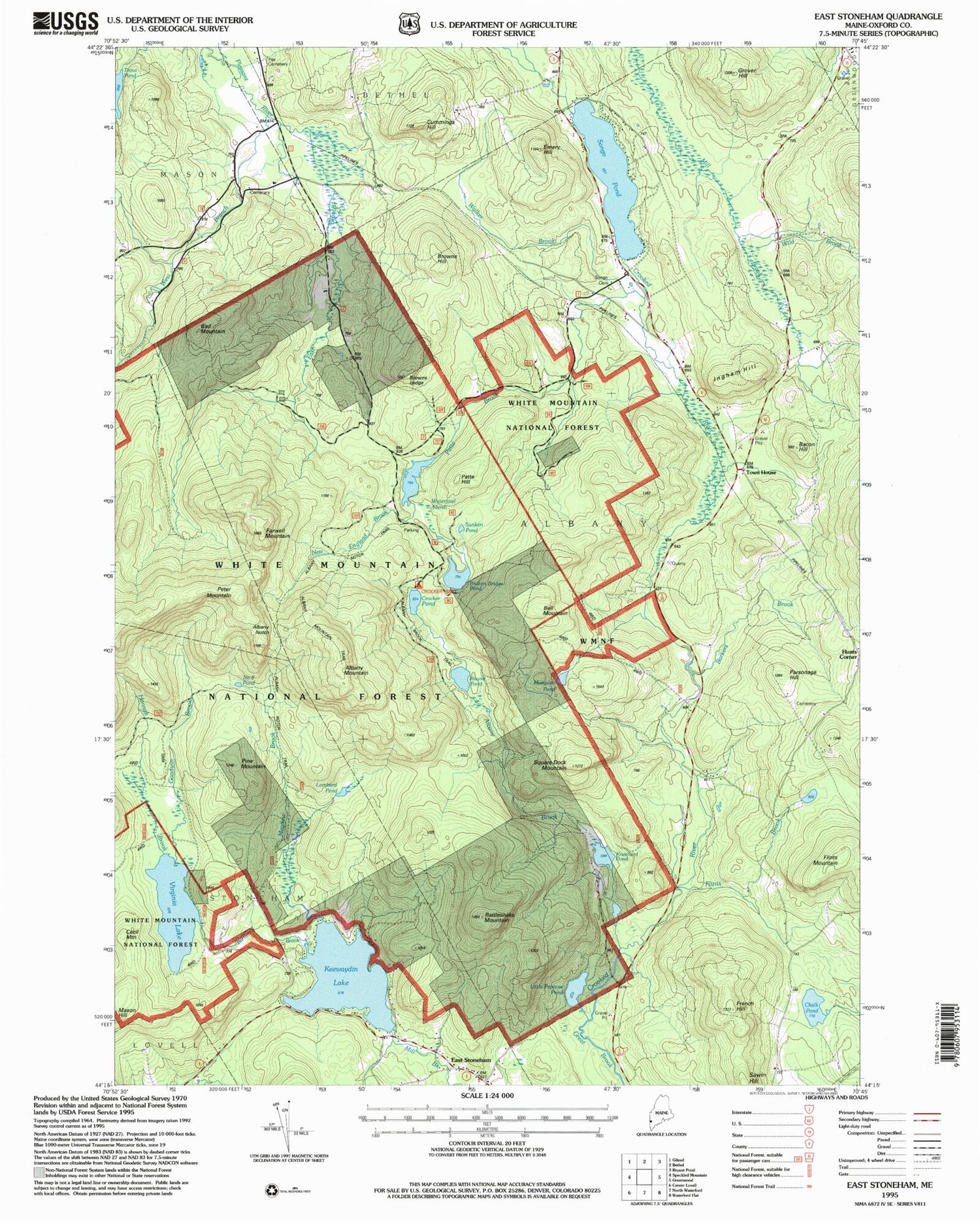
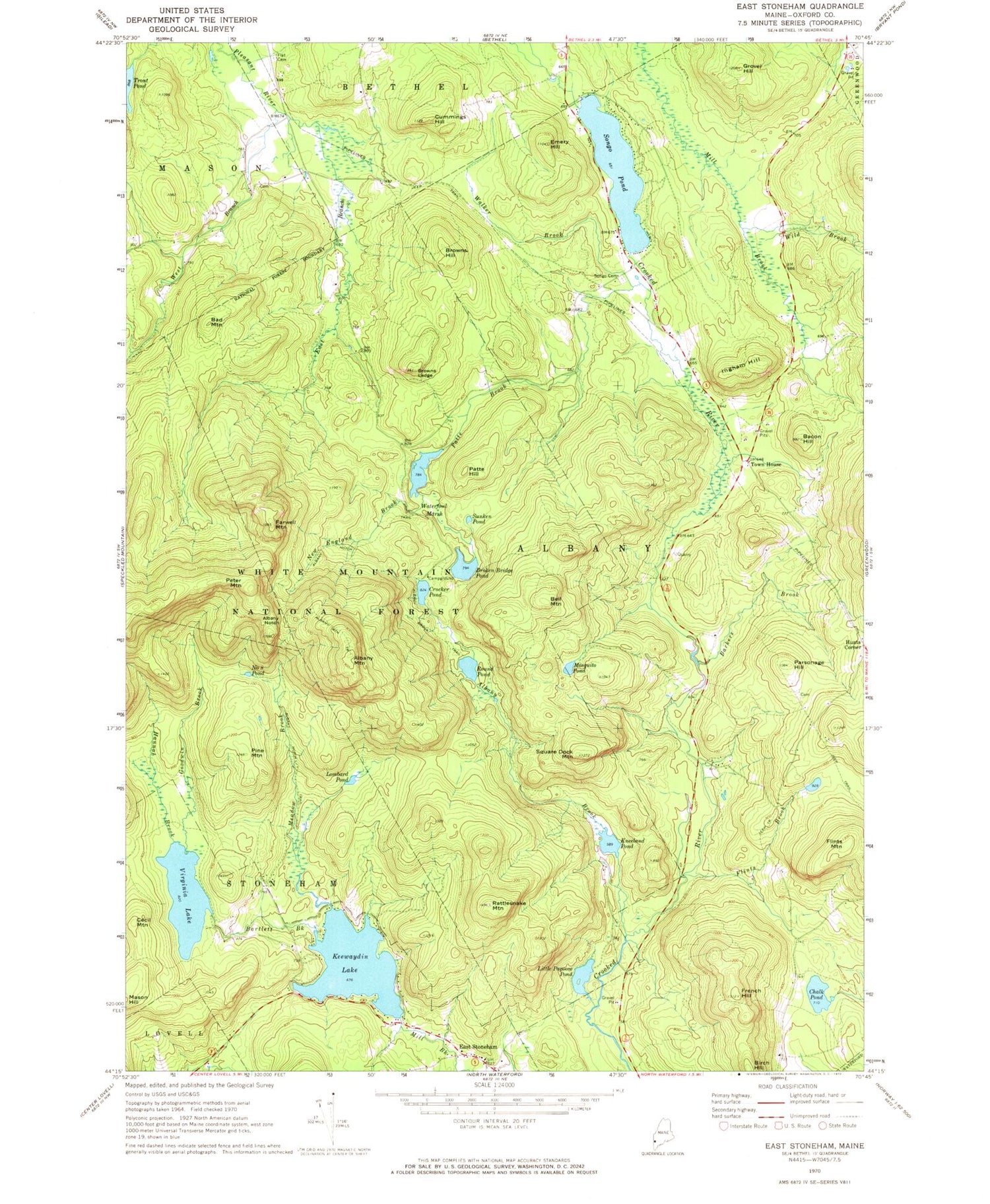
Classic USGS East Stoneham Maine 7.5'x7.5' Topo Map
Couldn't load pickup availability
Historical USGS topographic quad map of East Stoneham in the state of Maine. Typical map scale is 1:24,000, but may vary for certain years, if available. Print size: 24" x 27"
This quadrangle is in the following counties: Oxford.
The map contains contour lines, roads, rivers, towns, and lakes. Printed on high-quality waterproof paper with UV fade-resistant inks, and shipped rolled.
Contains the following named places: Bartlett Brook, Flints Mountain, Albany Brook, Albany Brook Trail, Albany Mountain, Albany Mountain Trail, Albany Notch, Albany Notch Trail, Bacon Hill, Bad Mountain, Barkers Brook, Bell Mountain, Sawin Hill, Broken Bridge Pond, Browns Hill, Browns Ledge, Cecil Mountain, Chalk Pond, Crocker Pond, Cummings Hill, East Branch Pleasant River, East Stoneham, Emery Hill, Farwell Mountain, Flat Cemetery, Flints Brook, French Hill, Goodwin Brook, Grover Hill, Hannah Brook, Ingham Hill, Keewaydin Lake, Kneeland Pond, Little Papoose Pond, Lombard Pond, Meadow Brook, Mosquito Pond, New England Brook, Number Eight Pond, Parsonage Hill, Patte Brook, Patte Hill, Peter Mountain, Pine Mountain, Rattlesnake Mountain, Round Pond, Songo Cemetery, Songo Pond, Square Dock Mountain, Sunken Pond, Town House, Trout Pond, Virginia Lake, Walker Brook, Waterfowl Marsh, West Branch Pleasant River, Wild Brook, Crocker Pond Campground, Unorganized Territory of South Oxford, Keewaydin Lake Dam, Virginia Lake Dam, Patte Brook Dam, Patte Brook Waterfowl Impoundment Reservoir, Bennett School (historical), Congregational Church, Flat School (historical), Mason School (historical), Albany Township, Stoneham Volunteer Fire Department, Stoneham Rescue EMS, Hunts Corner Cemetery


