MyTopo
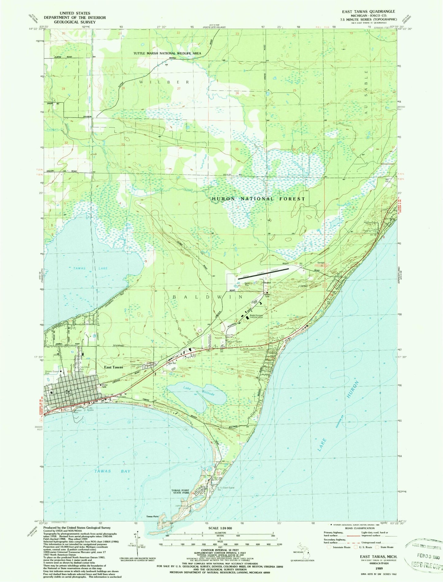
Classic USGS East Tawas Michigan 7.5'x7.5' Topo Map
Couldn't load pickup availability
Historical USGS topographic quad map of East Tawas in the state of Michigan. Map scale may vary for some years, but is generally around 1:24,000. Print size is approximately 24" x 27"
This quadrangle is in the following counties: Iosco.
The map contains contour lines, roads, rivers, towns, and lakes. Printed on high-quality waterproof paper with UV fade-resistant inks, and shipped rolled.
Contains the following named places: American Legion Cemetery, Apostolic Church of East Tawas, Bolen Park, Bright Horizons Learning Center, Christ Church Episcopal, Church of the Nazarene, City of East Tawas, Coast Guard Dock, Coast Guard Station Tawas, Dewey Durant Park, East Tawas, East Tawas Assembly of God Church, East Tawas City Hall, East Tawas City Park, East Tawas Fire Department, East Tawas Library, East Tawas Post Office, East Tawas State Dock, East Tawas Station, Fountain Creek, Grace Evangelical Lutheran Church, Gray Creek, Greenwood Cemetery, Holy Family Catholic Church, Holy Family Catholic School, Iosco County Airport, Iosco County Emergency Medical Services, Iosco-Arenac District Library, Jerrys Marina, Kingdom Hall of Jehovah's Witnesses, Kunze Creek, Lake Huron Community Church, Lake Solitude, Living Waters Christian Church, Lumbering on the Huron Shore Historical Marker, Michigan State Police Department, Saint Joseph's Cemetery, Silver Creek, Tawa Beach Post Office, Tawas Area Presbyterian Church, Tawas Bay, Tawas Bay Yacht Club, Tawas Beach Club, Tawas Lake, Tawas Light, Tawas Point State Park, Tawas Point State Park Campground, Tom Dillon Park, Township of Baldwin, Tuttle Ditch, Tuttle Marsh National Wildlife Area, ZIP Code: 48730