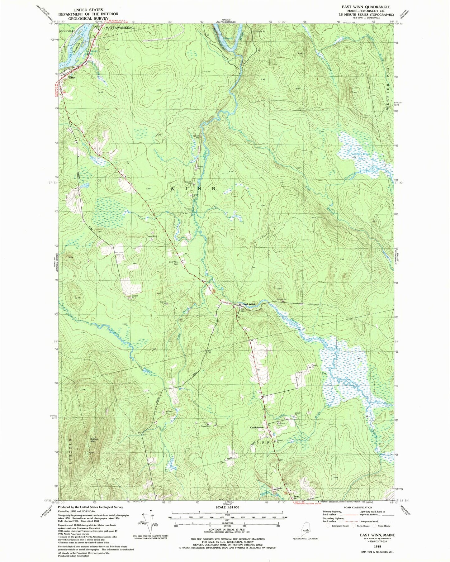
MyTopo
Classic USGS East Winn Maine 7.5'x7.5' Topo Map
Couldn't load pickup availability
Historical USGS topographic quad map of East Winn in the state of Maine. Map scale may vary for some years, but is generally around 1:24,000. Print size is approximately 24" x 27"
This quadrangle is in the following counties: Penobscot.
The map contains contour lines, roads, rivers, towns, and lakes. Printed on high-quality waterproof paper with UV fade-resistant inks, and shipped rolled.
Contains the following named places: Christian and Missionary Alliance Church, Contrary Brook, Contrary Brook Bog, Crocker Brook, Crockertown, Dwinal Pond, East Branch Mattakeunk Stream, East Winn, East Winn Cemetery, Five Island Rapids, Gott Brook, Houston Brook, Houston Island, Lee Winn School, Mattakeunk Stream, Potter Brook, Rollins Mountain, Town of Winn, Winn, Winn Post Office, ZIP Code: 04495