MyTopo
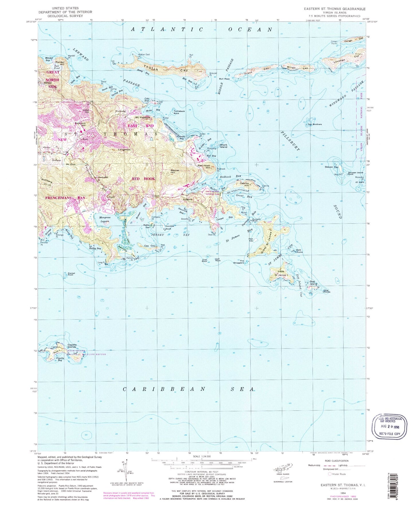
Classic USGS Eastern Saint Thomas Virgin Islands 7.5'x7.5' Topo Map
Couldn't load pickup availability
Historical USGS topographic quad map of Eastern Saint Thomas in the state of Virgin Islands. Map scale may vary for some years, but is generally around 1:24,000. Print size is approximately 24" x 27"
This quadrangle is in the following counties: St. John, St. Thomas.
The map contains contour lines, roads, rivers, towns, and lakes. Printed on high-quality waterproof paper with UV fade-resistant inks, and shipped rolled.
Contains the following named places: American Yacht Harbor Shopping Center, American Yacht Harbour Marina, Benner, Benner Bay, Benner Hill, Beverhout Point, Bluebeard Beach, Bolongo, Bolongo Bay, Bolongo Hill, Bolongo Point, Bovoni, Bovoni Bay, Bovoni Cay, Bovoni Hill, Broken Island, Buck Island, Buck Island Lighthouse, Bull Point, Bull Rock, Cabes Point, Cabrita Hill, Cabrita Point, Cabrita Point Beach, Calf Rock, Capella Bay, Capella Islands, Cas Cay, Cassi Hill, Christmas Cove, Church of God Academy, Clinton Phipps Racetrack, Coculus Point, Coculus Rock, Coki Bay, Coki Beach, Coki Point, Coki Point Estate, Compass Point, Congo Cay, Congo Point, Congo Ridge, Coral World Marine Park and Observatory, Cow Rock, Cowpet Bay, Current Hole, Current Rock, Deck Point, Dog Island, Dog Island Cut, Dog Rocks, Donoe, East End Family Health Center, East End Post Office, Estate Annas Retreat, Estate Bolongo, Estate Bovoni, Estate Charlotte Amalie, Estate Donoe, Estate Frydendal, Estate Frydenhoj, Estate Great Saint James Island, Estate Hoffman, Estate Langmath Mariendal, Estate Little Saint James Island, Estate Lovango Cay, Estate Mandal, Estate Nadir, Estate Nazareth, Estate Smith Bay, Estate Tabor and Harmony, Eva Bay, Eva Point, Fish Cay, Fish Hawk Marina, Footer Point, Fort Mylner Shopping Center, Four Winds Plaza Shopping Center, Frydendal, Grass Cay, Great Bay, Great Saint James Island, Grouper Point, Hoffman, Jack Rock, Jersey Bay, Langmath, Lee Point, Leeward Passage, Little Saint James Island, Long Point, Lovango Cay, Mandahl Bay Beach, Mandal, Mandal Bay, Mandal Hill, Mandal Point, Mangrove Lagoon, Mariendal, May Point, Middle Passage, Mingo Cay, Montagne Rouge, Mother East Point, Mouillage Cove, Mount Pleasant, Mount Zion, Muller Bay, Muller Bay Beach, Nadir, Nazareth, Nazareth Bay, New Herrnhut, New Herrnhut Moravian Mission, Nulliberg, Packet Rock, Patricia Cay, Patrick Point, Pelican Beach, Peterson Hill, Pillsbury Sound, Pineapple Beach, Prettyklip Point, Red Bay, Red Hook Ferry, Red Hook Shopping Center, Red Hook Visitors Center, Red Point, Redhook Bay, Redhook Ferry Dock, Redhook Hill, Redhook Point, Rotto Cay, Saint James Bay, Saint James Cut, Saint John Bay, Scott Beach, Secret Harbor Beach, Shark Island, Skipper Jacob Rock, Smith Bay, Spring Bay, Spring Point, Stalley Bay, Steven Cay, Stony Bay, Sunsi Bay, Sunsi Point, Thatch Cay, Thatch Hill, The Stragglers, Tillets Garden, Tillett Gardens Shopping Center, Turpentine Run, Turquoise Bay, Turquoise Beach, Turtleback Rock, Tutu, Tutu Bay, Tutu Beach, Tutu Census Designated Place, Tutu Park Mall Shopping Center, Two Brothers, Vessup Bay, Virgin Islands Fire Department - Lima Company Tutu Fire Station, Water Bay, Water Point, Welk Rocks, WGOD-AM (Charlotte Amalie)


