
MyTopo
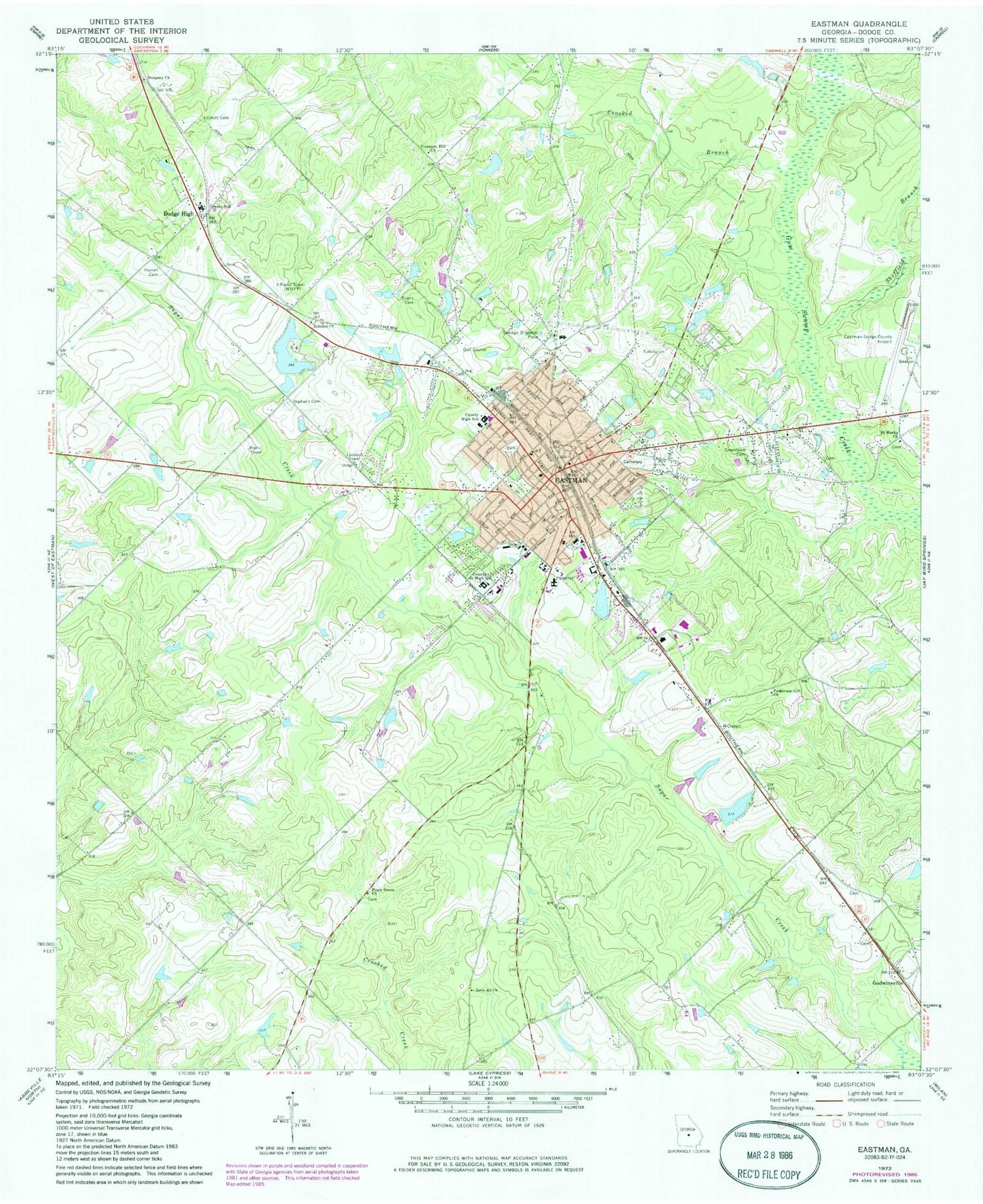
Classic USGS Eastman Georgia 7.5'x7.5' Topo Map
Couldn't load pickup availability
Historical USGS topographic quad map of Eastman in the state of Georgia. Map scale may vary for some years, but is generally around 1:24,000. Print size is approximately 24" x 27"
This quadrangle is in the following counties: Dodge.
The map contains contour lines, roads, rivers, towns, and lakes. Printed on high-quality waterproof paper with UV fade-resistant inks, and shipped rolled.
Contains the following named places: Amoskeag, City of Eastman, Crooked Branch, Dempsey, Dempsey Church, Dodge County, Dodge County High School, Dodge County Hospital, Dodge County Jail, Dodge County Sheriff's Office, Dodge Elementary School, Dodge High, Dodge Plaza Shopping Center, Eastman, Eastman Division, Eastman Elementary School, Eastman Fire Department Coleman Station 1, Eastman Fire Department Station 2, Eastman Methodist Church, Eastman Middle School, Eastman Police Department, Eastman Post Office, Eastman Regional Youth Detention Center, Eastman Youth Development Campus - Correctional Facility, Evans Cemetery, First Baptist Church of Eastman, Godwinsville, Greenlawn Cemetery, Harrell Pond, Harrell Pond Dam, Heart of Georgia Regional Airport, Jamieson Pond, Jamieson Pond Dam, Lockett Cemetery, Love All Church, Lowery, Orphans Cemetery, Parkerson Gift Church, Piney Grove Church, Pleasant Hill Church, Rosa Lee Cemetery, Saint Marks Church, Sheffield Branch, Tripps Lake, Tripps Lake Dam, WUFF-AM (Eastman), WUFF-FM (Eastman), Zebulon Church, ZIP Code: 31023


