MyTopo
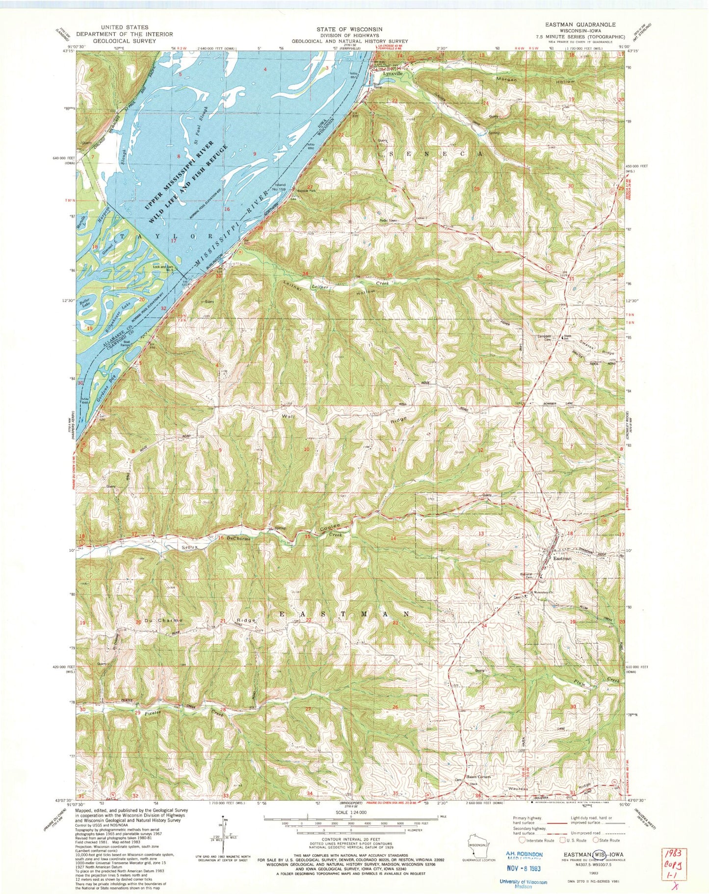
Classic USGS Eastman Wisconsin 7.5'x7.5' Topo Map
Couldn't load pickup availability
Historical USGS topographic quad map of Eastman in the states of Wisconsin, Iowa. Map scale may vary for some years, but is generally around 1:24,000. Print size is approximately 24" x 27"
This quadrangle is in the following counties: Allamakee, Crawford.
The map contains contour lines, roads, rivers, towns, and lakes. Printed on high-quality waterproof paper with UV fade-resistant inks, and shipped rolled.
Contains the following named places: Bonney School, Butler Lake, Campbell Cemetery, Du Charme Ridge, Du Charme Ridge School, Eastman, Eastman Elementary School, Eastman Post Office, Eastman Volunteer Fire Department, Gimmel Lake, Gordons Bay, Hazen Corners, Hazen Corners School, Island Number One Hundred Fifty-nine, Leitner Creek, Leitner Hollow, Leitner School, Lock and Dam 9, Lock and Dam No, Lynxville, Lynxville Elementary School, Morgan Hollow, National Cemetery, Oil Spring Creek, Phillip School, Pool 9, Rittenhouse Lake, Saint Paul Slough, Saint Wenceslaus Catholic Church Cemetery, Saint Wenceslaus Church, Shaw Hill School, Shulz Crossing Slough, South Elementary School, Village of Eastman, Village of Lynxville, Wagner School, Wall Ridge, Wall Ridge School, ZIP Code: 54626