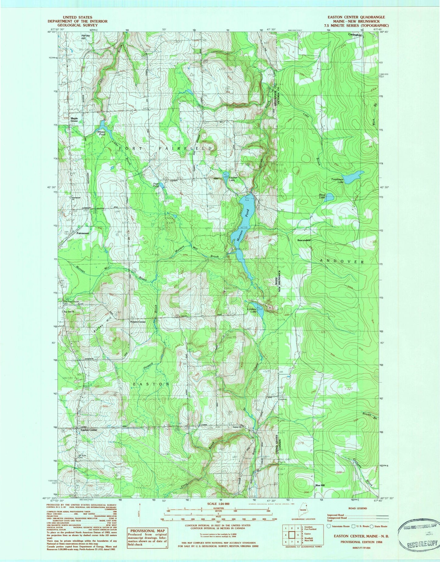
MyTopo
Classic USGS Easton Center Maine 7.5'x7.5' Topo Map
Couldn't load pickup availability
Historical USGS topographic quad map of Easton Center in the state of Maine. Map scale may vary for some years, but is generally around 1:24,000. Print size is approximately 24" x 27"
This quadrangle is in the following counties: Aroostook.
The map contains contour lines, roads, rivers, towns, and lakes. Printed on high-quality waterproof paper with UV fade-resistant inks, and shipped rolled.
Contains the following named places: Bryant Pond, Bryant Pond Dam, Easton Center, Easton Church, Emmanuel Church, Fairmount, Fischer Lake, Fling Brook, Haines Maple Grove Cemetery, Howard Brook, Kinney Hill, Ladner Fuller Cemetery, Ladner School, Lindsay Lake, Maple Grove, Monson Mill Brook, Monson Pond, Monson Pond Dam, Mount Shilo Cemetery, Page Pond, Pine Tree Church, Pine Tree Church Cemetery, Powers Corner, Town of Easton, ZIP Code: 04740