
MyTopo
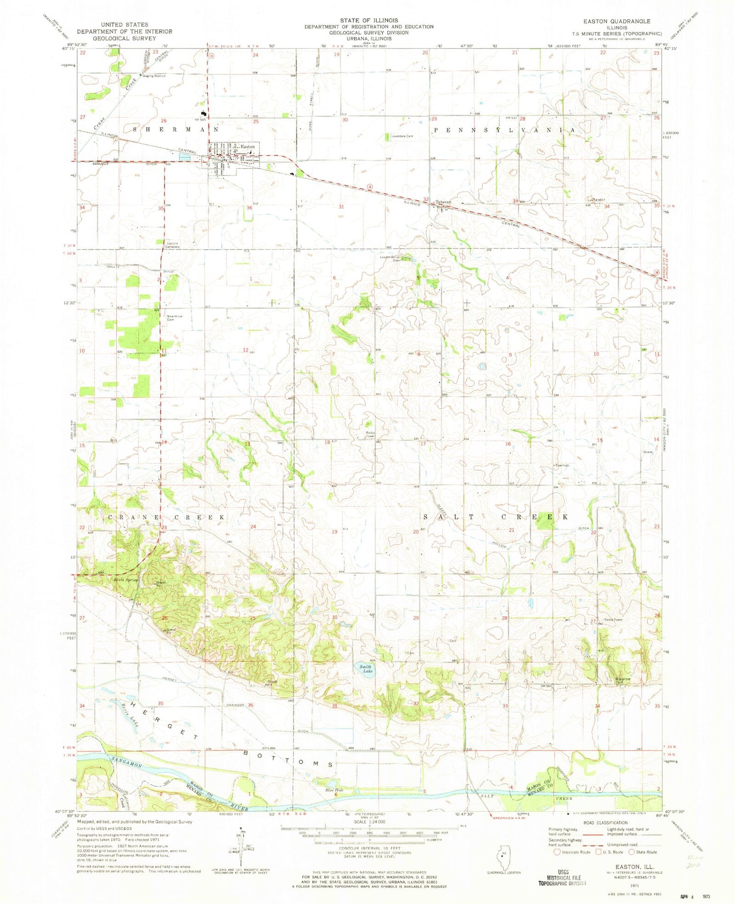
Classic USGS Easton Illinois 7.5'x7.5' Topo Map
Couldn't load pickup availability
Historical USGS topographic quad map of Easton in the state of Illinois. Map scale may vary for some years, but is generally around 1:24,000. Print size is approximately 24" x 27"
This quadrangle is in the following counties: Mason, Menard.
The map contains contour lines, roads, rivers, towns, and lakes. Printed on high-quality waterproof paper with UV fade-resistant inks, and shipped rolled.
Contains the following named places: Agnew Lake, Big Grove Cemetery, Blue Hole, Crites Cemetery, Danville School, Easton, Easton Cemetery, Easton Post Office, Easton Rural Fire Department, Grove Creek, Hall Ditch, Haw Grove School, Herget Bottoms, Illini Central Middle School, Knox School, Latimore Creek, Leases Grove Cemetery, Leases Grove Church, Leases Grove School, Leveldale Cemetery, Leveldale School, McCarty School, Mount Olive Church, New Hope Cemetery, Reavis Spring School, Revis Hill Prairie Nature Preserve, Revis Lake, Revis Spring, Ross Tyrell Ditch, Salt Creek, Salt Creek Townhall, Samuels Ditch, Sleepy Hollow, Smith Lake, Teheran, Township of Salt Creek, Village of Easton, Walker Grove School, ZIP Code: 62633


