MyTopo
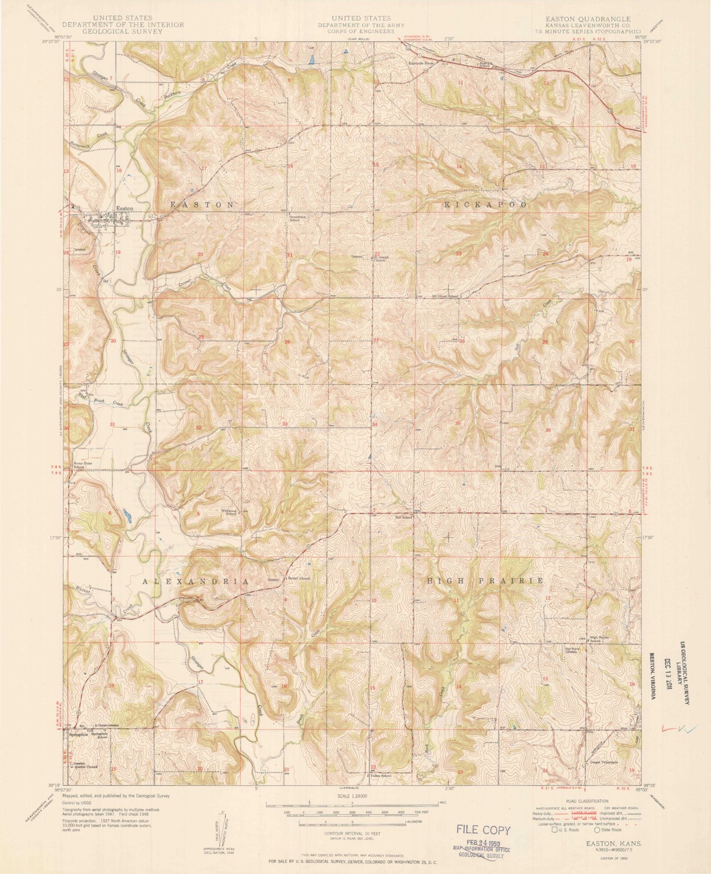
Classic USGS Easton Kansas 7.5'x7.5' Topo Map
Couldn't load pickup availability
Historical USGS topographic quad map of Easton in the state of Kansas. Typical map scale is 1:24,000, but may vary for certain years, if available. Print size: 24" x 27"
This quadrangle is in the following counties: Leavenworth.
The map contains contour lines, roads, rivers, towns, and lakes. Printed on high-quality waterproof paper with UV fade-resistant inks, and shipped rolled.
Contains the following named places: Township of Easton, Walnut Creek, Buttermilk Creek, Dawson Creek, West Brush Creek, High Prairie Church, High Prairie School, High Prairie Cemetery, Township of High Prairie, Lake Stellamaris, Bell School, Brush Creek, Springdale Friends Church, Springdale, Saint Thomas Cemetery, Wildwood School, Cramer Creek, Eightmile House, Saint Joseph of the Valley Catholic Church, Happy Hollow Lake, Bathel Church, Easton, Buckhorn Creek, Alexandria (historical), Pleasant Ridge (historical), Mount Olivet (historical), Bethel Cemetery, Grandview School (historical), Junction School (historical), Mount Olivet School (historical), Pleasant Ridge High School, Springdale School (historical), Stony Point School (historical), Valley School (historical), Yllier Lake, Township of Kickapoo, Township of Alexandria, Alexandria Township Fire Department, Easton Township Fire Department, Kickapoo Township Fire Department Station 1, City of Easton, Pleasant Ridge Elementary School, Easton Unified School District Office, Pleasant Ridge Middle School, Country Care Nursing Home, Easton Post Office, Easton Sewer Treatment Plant, Risky Airport, Easton Cemetery, Friends Church Cemetery, Mount Olivet Cemetery, Township of Easton, Walnut Creek, Buttermilk Creek, Dawson Creek, West Brush Creek, High Prairie Church, High Prairie School, High Prairie Cemetery, Township of High Prairie, Lake Stellamaris, Bell School, Brush Creek, Springdale Friends Church, Springdale, Saint Thomas Cemetery, Wildwood School, Cramer Creek, Eightmile House, Saint Joseph of the Valley Catholic Church, Happy Hollow Lake, Bathel Church, Easton, Buckhorn Creek, Alexandria (historical), Pleasant Ridge (historical), Mount Olivet (historical), Bethel Cemetery, Grandview School (historical), Junction School (historical), Mount Olivet School (historical), Pleasant Ridge High School, Springdale School (historical), Stony Point School (historical), Valley School (historical), Yllier Lake, Township of Kickapoo, Township of Alexandria, Alexandria Township Fire Department, Easton Township Fire Department, Kickapoo Township Fire Department Station 1, City of Easton, Pleasant Ridge Elementary School, Easton Unified School District Office, Pleasant Ridge Middle School, Country Care Nursing Home, Easton Post Office, Easton Sewer Treatment Plant, Risky Airport, Easton Cemetery, Friends Church Cemetery, Mount Olivet Cemetery