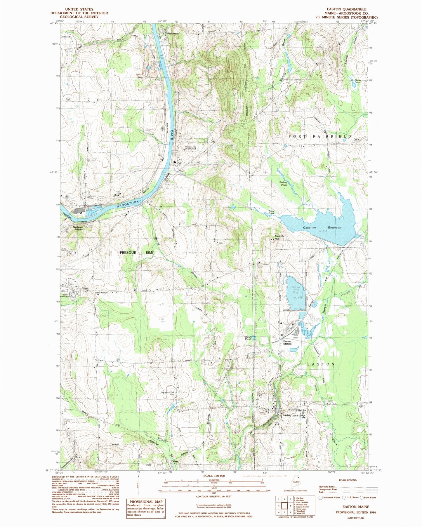
MyTopo
Classic USGS Easton Maine 7.5'x7.5' Topo Map
Couldn't load pickup availability
Historical USGS topographic quad map of Easton in the state of Maine. Map scale may vary for some years, but is generally around 1:24,000. Print size is approximately 24" x 27"
This quadrangle is in the following counties: Aroostook.
The map contains contour lines, roads, rivers, towns, and lakes. Printed on high-quality waterproof paper with UV fade-resistant inks, and shipped rolled.
Contains the following named places: Aroostook Medical Center TAMC's Health Sciences Library, Bartlett Cemetery, Bean Cemetery, Beans Cemetery, Bishop Pond, City of Presque Isle, Crown Ambulance, Driscoll Brook, Dyer Farm Cemetery, Easton, Easton Elementary School, Easton Fire Department, Easton Intake Dam, Easton Junior Senior High School, Easton Post Office, Easton Station, Easton United Methodist Church, Elliot Brook, Estes Park Cemetery, Fisher Lake, Glenwood Park Cemetery, Knight Cemetery, Lake Christina, Lake Christina Dam, Lake Josephine, Lake Josephine Dam, Melville Hill, Merritt Brook, Northern Light AR Gould Hospital, Parkhurst, Phair, Presque Isle Country Club, Quoggy Jo Ski Club, Rand Pond, Rogers Airport, The Wesleyan Church, Tuttle Pond, Washburn Junction, WOZI-FM (Presque Isle), ZIP Code: 04769