MyTopo
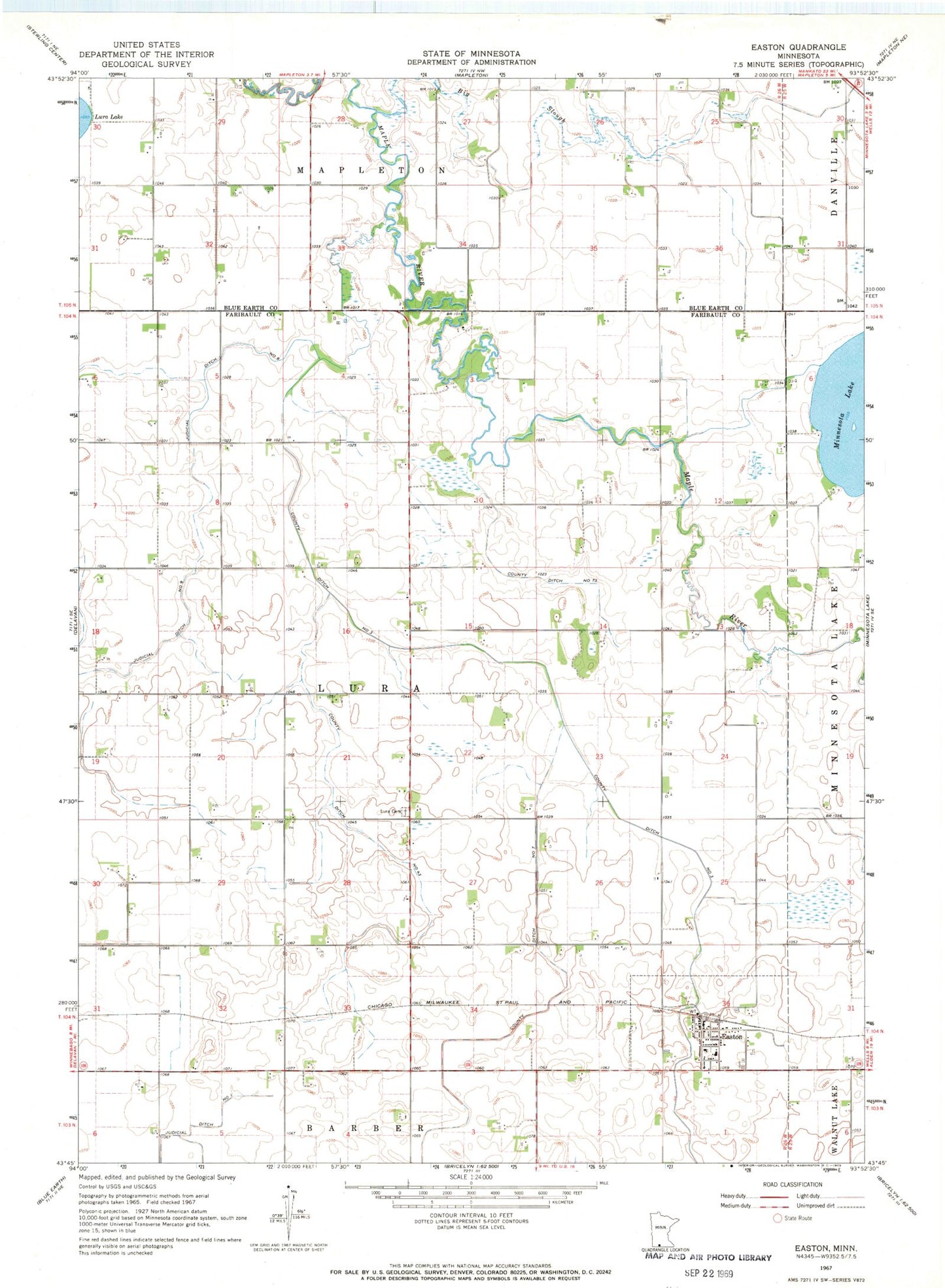
Classic USGS Easton Minnesota 7.5'x7.5' Topo Map
Couldn't load pickup availability
Historical USGS topographic quad map of Easton in the state of Minnesota. Map scale may vary for some years, but is generally around 1:24,000. Print size is approximately 24" x 27"
This quadrangle is in the following counties: Blue Earth, Faribault.
The map contains contour lines, roads, rivers, towns, and lakes. Printed on high-quality waterproof paper with UV fade-resistant inks, and shipped rolled.
Contains the following named places: Big Slough, City of Easton, County Ditch Number Fortythree, County Ditch Number Seven, County Ditch Number Seventythree, County Ditch Number Three, Easton, Easton City Hall, Easton Library, Easton Post Office, Easton Volunteer Fire Department, Judicial Ditch Number Nine, Lura Cemetery, Minnesota Lake, Minnesota Lake Dam, Our Lady of Mount Carmel Church, Saint Peter's Evangelical Lutheran Cemetery, Saint Peter's Lutheran Church, Township of Lura, ZIP Code: 56025