
MyTopo
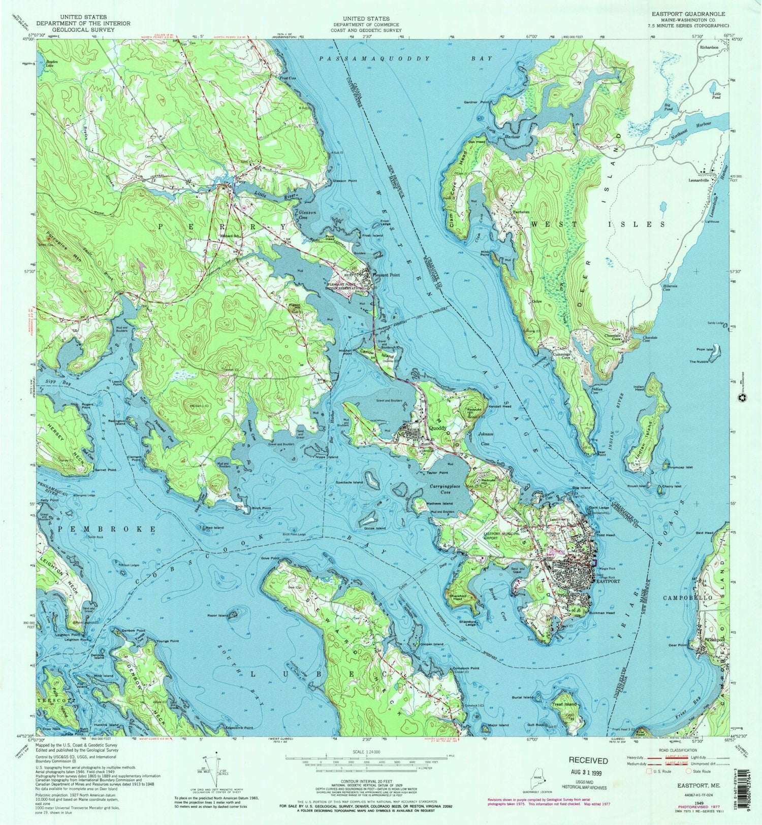
Classic USGS Eastport Maine 7.5'x7.5' Topo Map
Couldn't load pickup availability
Historical USGS topographic quad map of Eastport in the state of Maine. Typical map scale is 1:24,000, but may vary for certain years, if available. Print size: 24" x 27"
This quadrangle is in the following counties: Washington.
The map contains contour lines, roads, rivers, towns, and lakes. Printed on high-quality waterproof paper with UV fade-resistant inks, and shipped rolled.
Contains the following named places: Bar Harbor, Birch Point, Birch Point Ledge, Boyden Stream, Broad Cove, Buckman Head, Burial Island, Carlow Island, Carrying Place Cove, Clark Ledge, Cobscook Bay, Comstock Point, Cooper Island, Cooper Island Ledge, Deep Cove, Denbow Island, Denbow Point, Dog Island, East Bay, Eastport, Edgecomb Point, Estes Head, Falls Island, Fox Island, Friar Roads, Frost Cove, Frost Head, Frost Island, Frost Ledge, Gangway Ledge, Garnet Point, Gleason Cove, Gleason Point, Goose Island, Gove Point, Gull Rock, Harris Cove, Hibbard School, Hillside Cemetery, Huckins Island, Huckins Ledge, Johnson Cove, Kelly Point, Kendall Head, Leach Point, Leighton Point, Leighton Rock, Lincoln Cove, Little River, Long Cove, Major Island, Margie Rock, Mathews Island, Mink Island, Mitchell Point, Moose Island, Nipps Island, Page Rock, Pattangal Cove, Pennamaquan River, Pigeon Hill, Pleasant Point, Pleasant Point Reservation, Porcupine Mountain, Prince Cove, Quoddy, Razor Island, Red Cove, Red Island, Redington Island, Redoubt Hill, Redoubt Hill, Rogers Point, Ruth Point, Schooner Cove, Seward Neck, Shackford Head, Shackford Ledge, Sheep Cove, Sipp Bay, Smalls Cove, Smelt Brook, Smith Rock, South Bay, Spectacle Island, Taylor Point, Todd Head, Treat Island, Western Passage, Wilson Ledges, Youngs Cove, Youngs Point, Clement Point, Perry, Dog Island Light, WSHD-FM (Eastport), Eastport Municipal Airport, City of Eastport, Passamaquoddy Pleasant Point Reservation, Town of Perry, Perry Pump Station Dam, Boyden Stream Reservoir, Boyden Lake Dam, Barracks Museum, Bayside Cemetery, Blakeley Memorial Methodist Church, Boynton Street Historic District, Eastport Elementary School, Eastport Fish Pier, Eastport Gallery and Arts Center, Eastport Historic District, Eastport Municipal Pier, Eastport Post Office, Episcopal Union Church, Fort Sullivan (historical), Half Moon Cove, Monument Square, Mustard Mill Museum, Overlook Park, Peavey Memorial Library, Perry Elementary School, Perry Post Office, Quoddy Tides Foundation, Quoddy Tides Foundation Marine Library, Shead High School, The Seaview Campground, Washington County Marine Trades Center, Cornerstone Baptist Church, Pleasant Point Fire Department, Eastport Municipal Fire Department Station 1, Eastport Fire Department Quoddy Village Station, Perry Volunteer Fire Department, Downeast Emergency Medical Services Eastport, Sipayik Ambulance Corporation, Pleasant Point Passamaquoddy Reservation Police Department, Eastport Police Department, Leland Cemetery, Beatrice Rafferty School, Westlawn Institute of Marine Technology


