MyTopo
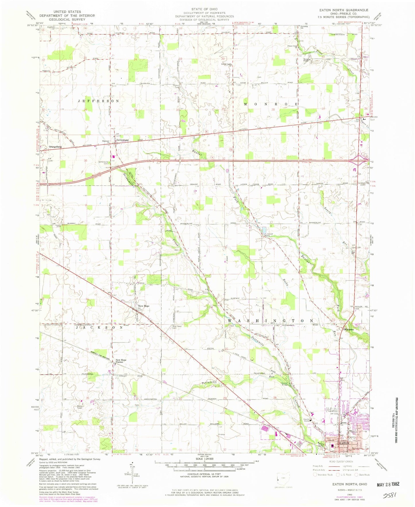
Classic USGS Eaton North Ohio 7.5'x7.5' Topo Map
Couldn't load pickup availability
Historical USGS topographic quad map of Eaton North in the state of Ohio. Map scale may vary for some years, but is generally around 1:24,000. Print size is approximately 24" x 27"
This quadrangle is in the following counties: Preble.
The map contains contour lines, roads, rivers, towns, and lakes. Printed on high-quality waterproof paper with UV fade-resistant inks, and shipped rolled.
Contains the following named places: Barnes Farm, Bowling Trailer Park, Christman Bridge, City of Eaton, County Home Cemetery, Darble Farm, Eaton Fire and EMS Division Station 2, Eaton First Church of the Nazarene, Ebenezer, Ebenezer Church, Ebenezer Post Office, First Baptist Church, First Church of God, Frame Cemetery, Gateway Baptist Church, Gettysburg, Gettysburg Cemetery, Gettysburgh Post Office, Greenbriar Nursing Center, Growing Acres Farm, Lee Farms, Lone Sycamore Farms, Lynch Farms, Lynch's Farms, McFadden School, Miller Farms, Murphy Farms, National Trail Family Farm, National Trail High School, New Hope, New Hope Cemetery, New Hope Station, New Hope Station Post Office, New Hope United Methodist Church, Northedge Shopping Center, Oklahoma, Orangeburg, Periwinkle Run, Petry Cemetery, Preble County Home, Preble County Sheriff's Office, Prices Creek Church of the Brethren, Scottish Crest Farms, Sherer Cemetery, Spacht Cemetery, Stamback School, Studebaker Farms, Stump Cemetery, Township of Monroe, Township of Washington, Wares Chapel Cemetery, Wares Chapel United Methodist Church, Westview Acres Care Center, Zion Church, Zion Church Graveyard, ZIP Code: 45320