MyTopo
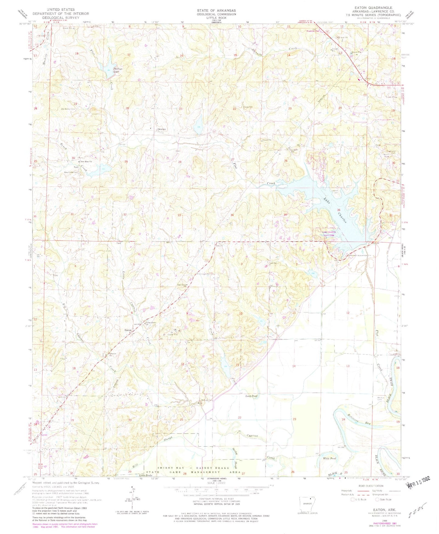
Classic USGS Eaton Arkansas 7.5'x7.5' Topo Map
Couldn't load pickup availability
Historical USGS topographic quad map of Eaton in the state of Arkansas. Map scale may vary for some years, but is generally around 1:24,000. Print size is approximately 24" x 27"
This quadrangle is in the following counties: Lawrence.
The map contains contour lines, roads, rivers, towns, and lakes. Printed on high-quality waterproof paper with UV fade-resistant inks, and shipped rolled.
Contains the following named places: Bench Creek, Big Cypress Creek, Brushy Pond, Cedar Grove Church, Crow Creek, Denton, Eaton, Fish Pond, Flat Creek, Flat Creek Site Five Dam, Flat Creek Site Five Reservoir, Flat Creek Site Four Dam, Flat Creek Site Four Reservoir, Flat Creek Site One Dam, Flat Creek Site Six Dam, Flat Creek Site Six Reservoir, Flat Creek Site Three Dam, Flat Creek Site Two Dam, Flat Creek Site Two Reservoir, Lake Charles, Lake Charles State Park, Lawson Cemetery, Lebanon Church, Little Cypress Creek, Long Pond, McNutt Cemetery, New Hope Cemetery, New Hope Church, Oak Grove Church, Oak Ridge School, Old Bethel Cemetery, Phillips Cemetery, Phillips Lake, Powhatan Cemetery, Ralph McDonald Lake, Ralph McDonald Lake Dam, Robinson Bay, Sawlog Slough, Sharp Cemetery, Shirey Bay-Rainey Brake State Game Manag, Township of Black River, Township of Black Rock, Township of Eaton, Township of Flat Creek, White Pond, ZIP Codes: 72440, 72458