
MyTopo
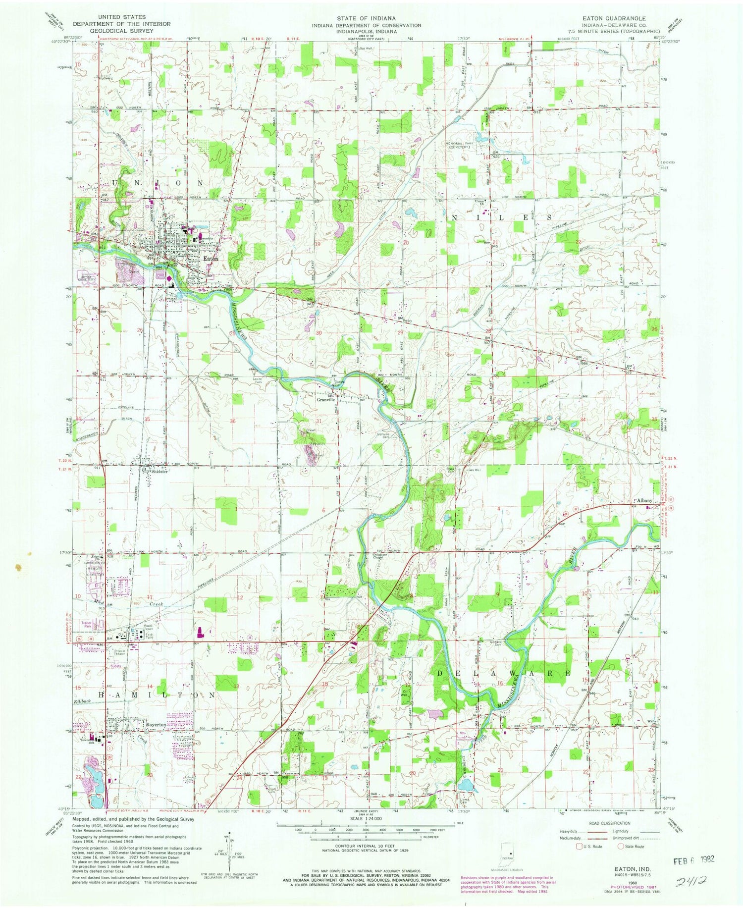
Classic USGS Eaton Indiana 7.5'x7.5' Topo Map
Couldn't load pickup availability
Historical USGS topographic quad map of Eaton in the state of Indiana. Map scale may vary for some years, but is generally around 1:24,000. Print size is approximately 24" x 27"
This quadrangle is in the following counties: Delaware.
The map contains contour lines, roads, rivers, towns, and lakes. Printed on high-quality waterproof paper with UV fade-resistant inks, and shipped rolled.
Contains the following named places: Black Cemetery, Bosman Ditch, Campbell Creek, Chuck's Airport, Cullen Cemetery, Delaware Chapel, Eaton, Eaton Elementary School, Eaton EMT, Eaton Police Department, Eaton Post Office, Eden Church, Finney's Airpark, Gardens of Memory Cemetery, Godlove Cemetery, Granville, Granville Cemetery, Hamilton Township Fire Department, Holdren Ditch, Horizon Field, Leaird Cemetery, Memorial Park, Rees Ditch, Royerton, Shideler, Swearengen Ditch, Town of Eaton, Township of Delaware, Township of Niles, Union Cemetery, Union Church, Union Church Cemetery, White Church, ZIP Codes: 47320, 47338


