MyTopo
Classic USGS Ebenezer Mississippi 7.5'x7.5' Topo Map
Couldn't load pickup availability
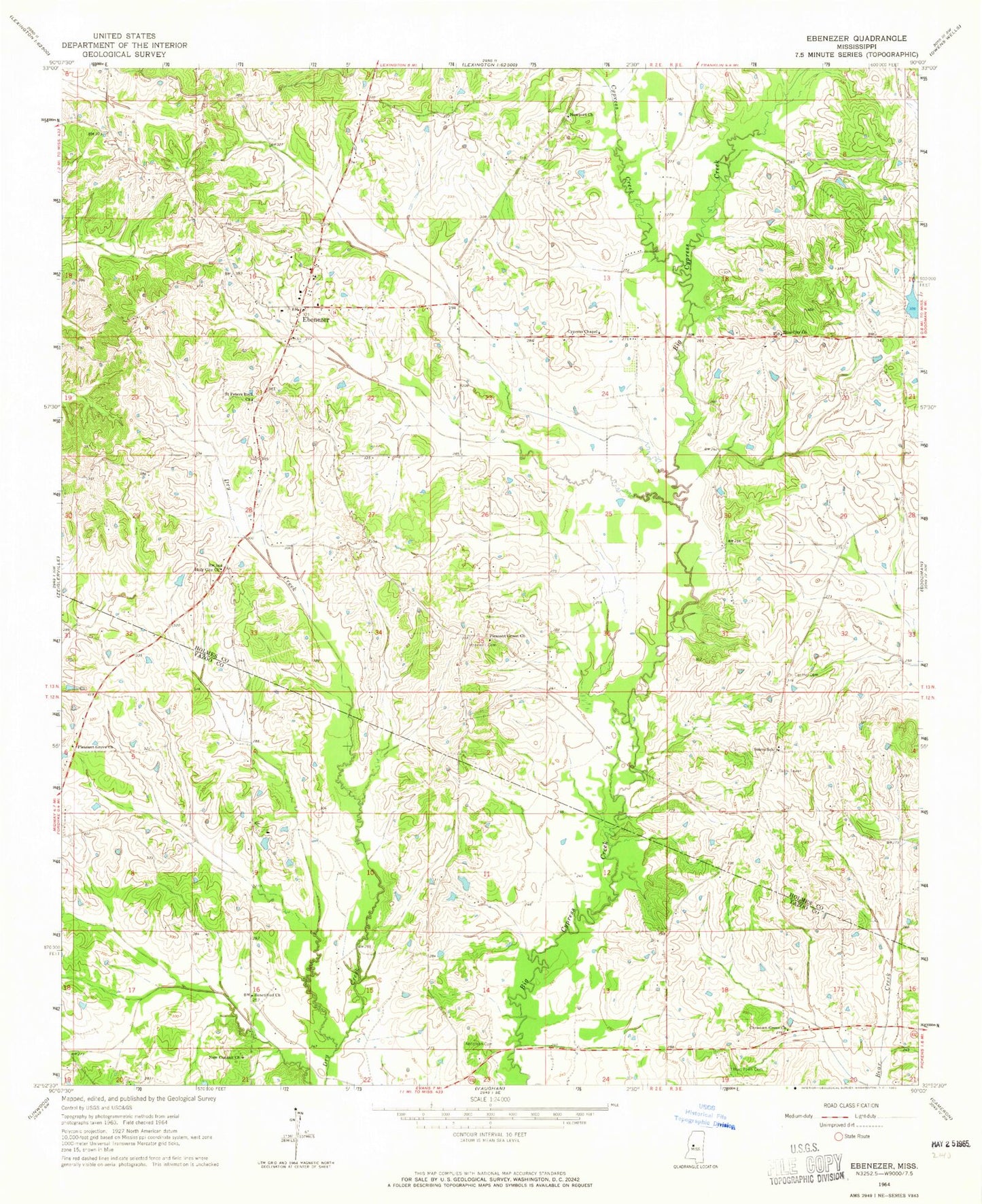
Historical USGS topographic quad map of Ebenezer in the state of Mississippi. Map scale may vary for some years, but is generally around 1:24,000. Print size is approximately 24" x 27"
This quadrangle is in the following counties: Holmes, Yazoo.
The map contains contour lines, roads, rivers, towns, and lakes. Printed on high-quality waterproof paper with UV fade-resistant inks, and shipped rolled.
Contains the following named places: Anderson Cemetery, Bisland Bayou, Bryan Swilley Pond Dam, Central Baptist Church, Central Cemetery, Christian Grove Church, Cypress Chapel, Cypress Creek, Cypress Creek Campgrounds, E F Crenshaw Junior Pond Dam, Ebenezer, Ebenezer Baptist Church, Ebenezer Baptist Church Cemetery, Ebenezer Methodist Church, Ebenezer Methodist Church Cemetery, Hart Town Cemetery, Holy City Church, Hoover Cemetery, Hopewell Cemetery, New Canaan Church, Newport Church, Pleasant Green Church, Pleasant Grove Church, Rogers Cemetery, Rule Cemetery, Saint Peters Rock Church, Salem School, Sanctified Church, Smith Cemetery, Supervisor District 3, Tackett Watershed 11 Dam, Truly Cemetery, Twin Lakes Subdivision Lake Dam, W H Austin Pond Dam, Zion City Church