
MyTopo
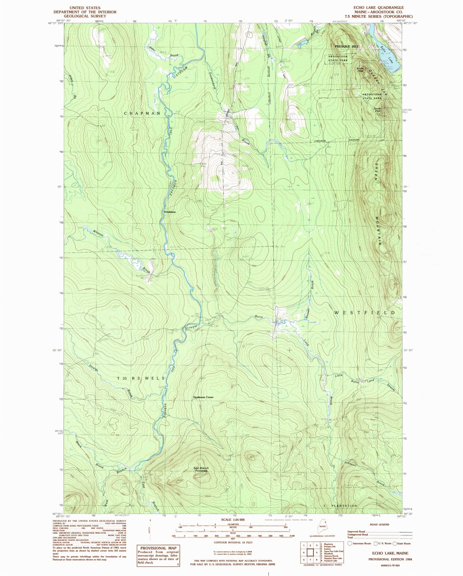
Classic USGS Echo Lake Maine 7.5'x7.5' Topo Map
Couldn't load pickup availability
Historical USGS topographic quad map of Echo Lake in the state of Maine. Map scale may vary for some years, but is generally around 1:24,000. Print size is approximately 24" x 27"
This quadrangle is in the following counties: Aroostook.
The map contains contour lines, roads, rivers, towns, and lakes. Printed on high-quality waterproof paper with UV fade-resistant inks, and shipped rolled.
Contains the following named places: Aroostook State Park, Beacon Number 2, Black Brook, Burnt Land Brook, Burntland Stream, Burntland Stream Dam, Deadmans Corner, Dockendorff Brook, East Branch Dam, East Branch Pinnacles, East Branch Presque Isle Stream, East Branch Presque Isle Stream Reservoir, Echo Lake, Green Mountain, Grendell Brook, Grindstone, Johnson Brook, Little Burnt Land Stream, North Peak, Presque Isle Snowmobile Club Lodge, Quaggy Joe, Shields Brook, South Peak, T10 R3 WELS, Town of Chapman, West Branch Presque Isle Stream, Whitney Brook, Whitney Brook Dam


