MyTopo
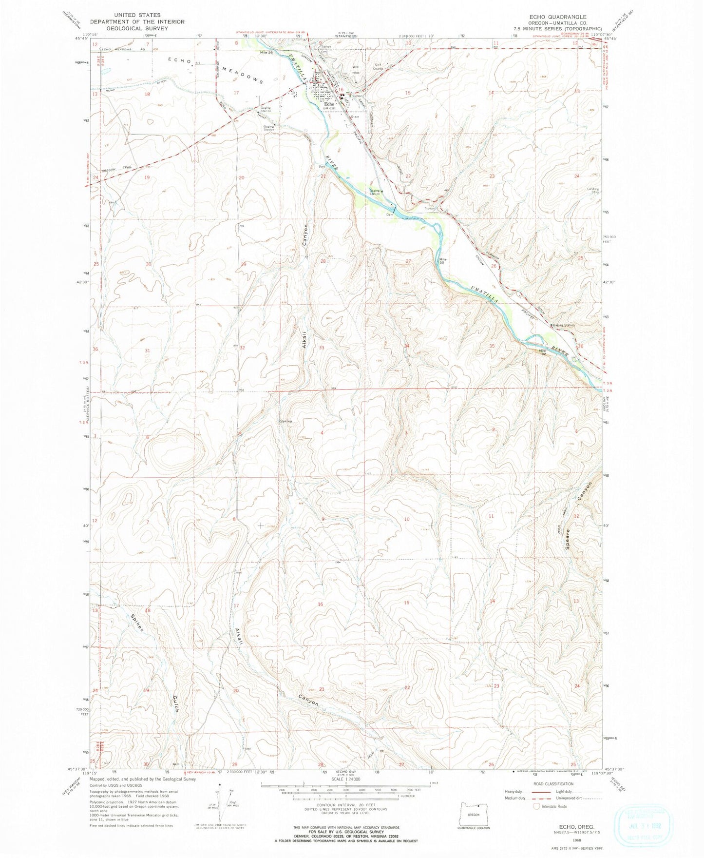
Classic USGS Echo Oregon 7.5'x7.5' Topo Map
Couldn't load pickup availability
Historical USGS topographic quad map of Echo in the state of Oregon. Map scale may vary for some years, but is generally around 1:24,000. Print size is approximately 24" x 27"
This quadrangle is in the following counties: Umatilla.
The map contains contour lines, roads, rivers, towns, and lakes. Printed on high-quality waterproof paper with UV fade-resistant inks, and shipped rolled.
Contains the following named places: Alkali Canyon, City of Echo, Cold Springs Diversion Dam, Echo, Echo City Hall, Echo Memorial Cemetery, Echo Municipal Court, Echo Post Office, Echo Public Library, Echo Public Works Department, Echo Rural Fire Protection District Station 1 Headquarters, Echo School, Fort Henrietta, Fort Henrietta and Chinese House, Fort Henrietta Park Echo, George Park, Oregon Trail Arboretum, Skate Park, Taylor Ditch, Westland Dam, ZIP Code: 97826