MyTopo
Classic USGS Eckerman Michigan 7.5'x7.5' Topo Map
Couldn't load pickup availability
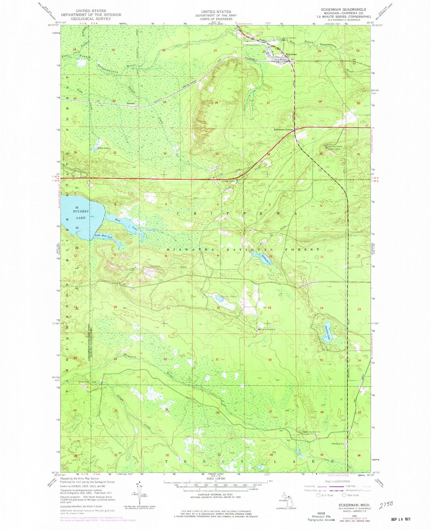
Historical USGS topographic quad map of Eckerman in the state of Michigan. Map scale may vary for some years, but is generally around 1:24,000. Print size is approximately 24" x 27"
This quadrangle is in the following counties: Chippewa.
The map contains contour lines, roads, rivers, towns, and lakes. Printed on high-quality waterproof paper with UV fade-resistant inks, and shipped rolled.
Contains the following named places: Creek Number Fourteen, Deerfoot Lake, East Branch Tahquamenon Wild and Scenic River, Eckerman, Eckerman Corner, Eckerman Corner Lookout Tower, Eckerman Post Office, Eckerman Station, Grants Creek, Hendrie River Camp, Howard City Club, Hulbert Lake, LaRock Cabins, Little Mud Lake, Mud Lake, Naugle Creek, No Doe Hunting Club, O Conner Airstrip, Pardy Pond, Petersburg Club, Riley Lake, Seewhy, Seewhy Post Office, Seewhy Station, Township of Chippewa, Williams Lake